Much like the girls all getting prettier at closing time, the campgrounds get a lot more appealing as departure day approaches. This is all the more true when your original reservation gets cancelled due to flooding and you’ve got less than two weeks to find an alternative. For us, Buffalo Bill State Park was that girl … err … campground.
Late in June of 2022, our famed Yellowstone bucket list camping trip hit a snag before we’d even left home. Flash flooding kyboshed our initial two-night stay in the park’s northern Mammoth Campground, leaving us in a panic. Finding an available campsite near Yellowstone on short notice is not an easy endeavor. Remarkably, we managed to book a site at Buffalo Bill State Park.
That we were able to find an available campsite on the actual road into the eastern entrance of Yellowstone National Park at the beginning of summer travel season had me concerned. Was this place going to be a disaster? Why was it not jam packed with campers?
In part, I think our luck stemmed from a sequential booking prerogative that releases campsites to the public periodically rather than all at once. True or not, our luck was wonderful, and my concerns wholly misplaced, because Buffalo Bill State Park was just delightful as a closing time hookup.
BUFFALO BILL STATE PARK LOCATION

Buffalo Bill State Park is located anywhere from 10 to 16 miles west of Cody, Wyoming on Highway 14/16/20, also known as the Buffalo Bill Scenic Byway. This puts the park anywhere from 37 to 43 miles from the east entrance to Yellowstone.
I give a range of distances because this state park is a strip of land, not entirely contiguous, around three-quarters of the Buffalo Bill Reservoir on the Shoshone River. Park facilities are situated like postage stamps at different places within those lands. Depending on which you are using, the distance to town or national park varies.
BUFFALO BILL STATE PARK SETTING
The scenery surrounding the park is beautiful, but stark. The reservoir fills the west end of Shoshone Canyon along the eastern flank of the Absaroka Mountains. It’s semi-arid land with exposed sedimentary and igneous geology all around.
As a geo-nerd, I loved it and wished our schedule had allowed for hiking and exploration into the nearby hills. My only gripe is with the powerlines that interrupted an otherwise gorgeous view from our campground.
The only greenery to be found are trees in the upper elevations of the mountains, or crops in the irrigated river valley floors. It’s quite a contrast to the forested Yellowstone National Park, not too far away.

There’s also plenty of water thanks to the reservoir, which itself rises and falls with precipitation in the Rocky Mountains and agricultural demand downstream. In a sense, the lake is a giant oasis in the midst of a near-desert landscape and unsurprisingly, a popular recreational escape for locals and interlopers alike.
Night skies are quite good for stargazing. Cody is a city of 10,000 so there is some light pollution to the east, though Rattlesnake and Cedar Mountains block much of the ground level leakage.
Like seemingly all places in such a setting, wind is just a part of life. It’s either outright windy or breezy. This certainly keeps the bugs away and offers some relief from the beating sun, but it can also make for nerve-wracking tent and awning experiences.
BACKGROUND ON THIS REVIEW
According to the handy Buffalo Bill State Park pamphlet I received upon our check-in, there are 10 named recreation sites around the reservoir. This includes the Buffalo Bill Dam & Visitor Center which I mentioned in my earlier post on things to do in Cody, Wyoming.
All but one (Bartlett Lane) are situated along the north shore of the reservoir or around its western tip. The bulk of this review will focus on the largest of them, North Fork Campground, where we camped. I’ll add brief explanations and lots of pictures of most of the other park areas. Only Marquette and Bartlett Lane will be missing, as I was unable to get to them.
NORTH FORK CAMPGROUND LAYOUT

As I mentioned, we camped at North Fork Campground found on the north side of the Shoshone River where it enters the reservoir. With 80 RV and 6 tent campsites, plus a group area, it’s the largest and best serviced campground in Buffalo Bill State Park.
All the campgrounds along the north shore are sandwiched between the highway and the lake/river. With no tree cover to speak of, highway noise is inevitable. It’s a busy road during the daytime with tourists making their way into Yellowstone or back, but it diminishes substantially into the night.

North Fork has two original loops plus a third, newer strip of campsites. A long entrance road swings westward and then southward before meeting a t-intersection. Turn left and you go to the larger of the two loops. Turn right and go to the smaller, formerly known as North Fork Lower Loop Campground. The third suite of campsites are located north of the larger loop along a gravel road that parallels the main access road to the campground.
The main loop is a large, oblong loop cut into three segments by two crossroads. There are 41 pullout style campsites on either side of the loop road (2 of those are on one of the crossroads). The 6 walk-in tent sites are in this loop as well.

The lower loop is a teardrop shaped loop with an additional 15 pullout style campsites, again on either side of the loop road.
The remaining 24 campsites at North Fork Campground are angled back-in style sites on either side of the gravel road through the newer third campsite strip.
Aside from that third group of campsites, all roads to and within the campground are paved. It’s grainy asphalt, but asphalt, nonetheless.
NORTH FORK CAMPGROUND CAMPSITES
For ease of explanations, I’m going to divide the primary campground loop into 3 segments (A, B, C) with the crossroads acting as delineations between the segments. Segment A will be nearest the entry (i.e. the west). Segment B will be the center and segment C, the furthest from entry (the east). I’m doing this because the services offered in this campground get a bit complicated.

I’ll start with the easiest part. None of the campsites have sewer service.
Electricity, by contrast, is available on all sites in segments A and B only. That is sites 48 through 48 and 70 through 88.
On-site water gets odd with only the interior sites of segment A having such luxury. That is sites 48, 50, 79, 81, 83, 85, 87, and 88. I can only imagine the government oversight that resulted in such a strange implementation of utilities.
Our site was in segment B, site 77. As would become all too common on our trip through the USA, it was a backwards site being located on the interior of the loop road. That loop road had signage stating it was a one-way road despite being fairly spacious.

Noting the naughty ways of other trailers already setup at Buffalo Bill State Park, and recognizing our campsite was near a crossroads, we decided to ignore road signage and set up our trailer backwards in a backwards site thereby making it properly facing. Follow that?
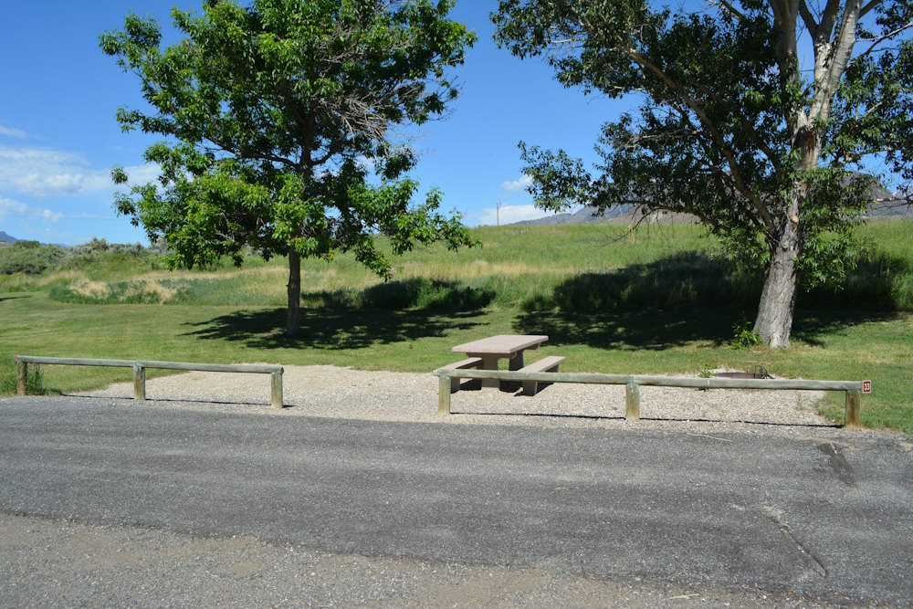
Each pullout site has a paved, arcuate driveway with a patch of gravel separating it from the main loop road. As mentioned, the asphalt is quite grainy, but it is level and decent for stabilizing your RV. The pullouts aren’t humongous but should be able to accommodate most rigs.
A log fence separates the driveway from the loop interior where the campsite amenities are located. This fence has one open segment allowing users to enter their campsite, typically by the immovable picnic table. A low-profile firepit with a flippable grill is also found at each campsite.

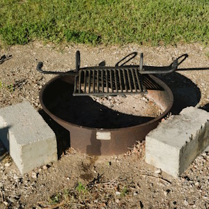
Despite my wily ways of parking backwards on a backwards site, sanity remained elusive as power (and water) hookups are found just inside that log fence. So, while I’d solved the problem of our trailer door entry, I ended up having a power cord lying beneath the trailer and across our walking path into our site. I just can’t win with this stuff!
The grounds around the picnic table are gravel with the surrounding grass and weeds attempting to encroach. There are, however, three accessible campsites that employ an identical site layout but have a concrete pad rather than gravel where the picnic table and firepit are located. They also have elevated, charcoal BBQs which is a nice addition.

Beyond the gravel is endless irrigated and mowed grass. There is absolutely no privacy between campsites. They’re not crammed together by any means, but you’ll have nothing preventing you from people watching your neighbours. Or they, you.
An assortment of shade trees has been planted around the entire loop, typically clustered by each campsite. The trees are in varying stages of life with some quite mature and thus offering reliable shade. When that shade appears, however, depends on the location of the individual campsite. Some will get morning shade, others evening shade. But with an overall east-west directionality, the shade is sadly not well aligned with the actual campsites. And don’t expect any of it to shelter your actual RV.
Still, it’s a welcome attempt at providing shelter. One look around at the lands beyond the campground makes it clear that trees are a luxury here. And that sun gets damn hot in the summer. Having a spot nearby to set your lawn chair under while enjoying a cool beverage is a must.
NORTH FORK CAMPGROUND TENT ONLY AREA
The tent only area in North Fork is located at the far east end of the main campground loop. There are 6 sites, all walk-ins but it’s a short walk. This area is essentially a bulbous extension of the main loop and comprises a treed, grassy area.

Each of the tent sites has a gravel pad with firepit and immovable picnic table. The sites are oriented NW-SE and have a windbreak fence on their NW and SW sides. Tents themselves have no specified space for setup, so just put them up in the grass.
They’re nice campsites, with a nice view of the reservoir and mountains behind. A couple sites are well-sheltered with mature trees. However, the proximity to the highway is surely a bit noisy for tent camping. A secondary road over the reservoir also borders the tent area, so don’t expect the most peaceful tent camping experience.
I’d also go so far as to say, these sites are a bit on the rundown side. Grass is encroaching on the gravel pads and the fencing needs a paint job. Perhaps I’m being nitpicky but considering the state of the remainder of the campground, this stood out to me.

NORTH FORK CAMPGROUND LOWER LOOP CAMPSITES
The second, smaller loop was once considered its own separate campground, but is now lumped in as part of North Fork Campground.
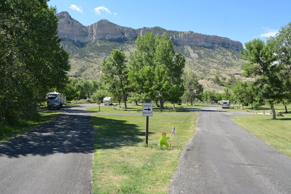
The 15 campsites in this loop are identical pullout style sites to the main loop. None of these have on-site water or power, so expect generators. Gotta run that a/c somehow.
Situated on a point bar of the Shoshone River, the one advantage this loop has over its big brother is a forested area between the campground and the river. There are some genuinely large trees, cottonwoods maybe, that offer full shade over the lands beneath.
Unfortunately, only one of the campsites resides in the trees. Four more border onto the trees with a couple having lovely sightlines and access to the river itself.

The remaining campsites, found on either side of the access road, range from modestly sheltered by a couple trees to completely open to the sky.
It’s a shame this loop isn’t entirely powered as there are a few really nice campsites here. It’s further from the road and a bit more isolated from the other campgrounds. I could see myself really enjoying camping in this loop, but a generator would quickly destroy the mood.

THIRD CAMPSITE STRIP AT NORTH FORK CAMPGROUND
I wish this strip of sites had a proper name. It’s an obviously newer addition to the campground considering it doesn’t show up on current Google satellite images.
Found in the wild grass north of the main loop, I literally thought it was just makeshift overflow camping. Nothing more than level, gravel pads in the grass, there are zero services and zero trees here. You couldn’t pay me to camp on one of these sites.
Each has a moveable picnic table (that’s a plus, I guess) and a firepit. I suppose the views are decent with nothing but a potential neighbouring RVs to block it. You’ll get wind and presumably bugs all day long as the field in which this loop exists is nothing but wild grass and weeds.
I’m not sure why they added such a roughshod grouping of campsites when the remainder of this campground is so well-manicured. I hope they come cheap.


NORTH FORK REGISTRATION OFFICE, INFORMATION, AND HOST
Before you ever get to your campsite, you’ll be greeted by volunteers working in the registration kiosk. The kiosk is found just after entering the park off the parkway and they’ll get you straightened out for your stay at North Fork Campground.
I normally don’t make a big deal about these registration kiosks, but the lady working during our stay was incredibly friendly. She just oozed western hospitality.


North Fork also employs a campground host. They have a luxurious site just before that t-intersection I mentioned above. It’s a combination of pullout parking lot with back-in RV site. A shaded, fenced yard with a firepit gives it a down-home appeal.
To one side of the host’s site is an information board and on the other side is a woodshed. That is where you can obtain firewood, payable by a donation of your choice. Considering the dearth of trees anywhere around, this was a bit surprising to see. Unfortunately, we were too busy enjoying Cody’s attractions to have a campfire.
NORTH FORK CAMPGROUND VAULT TOILETS
The two campground loops employ vault toilets. The main loop has three, with two in the loop interior and one by the tent only area. The second loop has a single vault toilet.
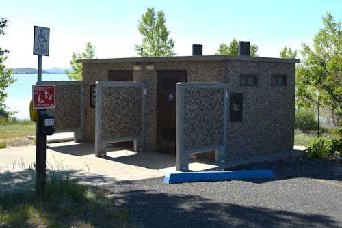
These vault toilets are robust structures, built of decorative exposed aggregate concrete. There are two rooms per structure, both unisex and both accessible with plenty of room to move around. All also have accessible parking and concrete pathways to the toilets.
At one time, these vault toilets had Men’s and Women’s sides. Even now, one side has a toilet and a urinal (blech) while the other side has two toilets. Why? I don’t know. It’s not like two people will enter either side at the same time. Sure is interesting to see, I’ll grant you that.
Sadly, as the calendar turned from June to July, they were already getting quite smelly. Sitting out in the open Wyoming sun with little to no air circulation within, they just bake in their own juices. I can’t imagine the hell they become by August.
Even more concerning, that newer third strip of campsites is serviced by two port-a-potty units. It’s as if feedback to the park designers mentioned the unpleasantness of vault toilets and the designers said, “Hold my beer.” I would never … ever … use one of these.


NORTH FORK CAMPGROUND SHOWER HOUSE
Thankfully, North Fork Campground has a shower house with flush toilets! It’s the only campground in all of Buffalo Bill State Park to offer such an amenity and the prime reason I chose to camp here.
It’s found immediately across from the campground host campsite, in a green space between the access road and the west end of the primary loop. Yeah, that’s hardly a convenient central location, but by golly I didn’t care.
The shower house consists of 4 large, unisex units each individually accessed from the outside. Each unit houses a large bathroom area with stainless steel flush toilet, sink, and mirror. It’s a bit prison-like, but again, I didn’t care.
Next to this bathroom area is the accessible shower area. The showers are a bit complicated with a normal height showerhead and a lower one for those in need of sitting to cleanse. A knob diverts water to the head of your choice. Neither nozzle is particularly wonderful, but they do the job.
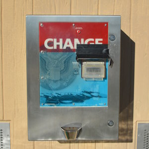
Showers are coin operated, and a coin dispensing machine is affixed to the exterior wall of the shower house. There’s a Pepsi machine as well should you need a cool, refreshing soda after a steamy shower.
The presence of flush toilets is the biggest plus of the shower house, but we did make use of the showers. They were fine with warm water and lots of space to manoeuvre. My only critique is that they are enclosed units with no air flow so they can get very humid inside which isn’t the greatest for feeling refreshed after a shower.



NORTH FORK CAMPGROUND DUMP STATION
The third option for waste disposal is to use your onboard facilities. This is the preferred option for those with large RVs.
A dual outlet dump station is located in a sweeping pullout next to the registration kiosk at the park entrance. Plenty of room here to accommodate multiple units without causing a backlog on the road in and out of the campground.
NORTH FORK CAMPGROUND POTABLE WATER
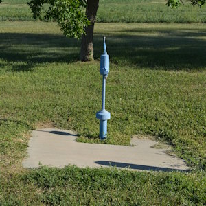
The dump station also has a potable water spigot for RV tank filling. Additional water taps are present in the two campground loops.
The current map shows 4 in the main loop, but I know for a fact there is at least a fifth not shown on the map. That’s the one we used, so either the map is incorrect, or I ingested something I should not have.
The lower loop has only 1 tap and the third campsite strip does not yet have any water supply. I guess they need to wander back to the dump station to fill a jug.
Most of the taps are located next to the vault toilets but a couple are present in open spaces between sites.

NORTH FORK CAMPGROUND PLAYGROUND

The interior of the main campground loop is a massive green space. It’s a mowed lawn requiring epic amounts of irrigation to keep green. Being next to a reservoir helps in this endeavour, but I can’t help thinking this is a colossal waste of resources. That said, it sure is nice to have!
There is ample space for any number of games requiring the tossing objects great distances. We played a rousing game of bocce during our free time, but you can certainly toss a football or Frisbee around with little issue. Hell, you could even work on your free kicks or short game if you wanted.

In the very center of this green space, is a child’s playground. Encircled by a pea gravel base, this combination metal and plastic climbing and slide apparatus will entertain the youngsters in your clan. It even has a concrete sidewalk all the way to the nearest vault toilet which, in turn, has accessible parking. This enables mobility-compromised grandparents to watch their grandkids play, which is fantastic.
Assuming it isn’t too hot, of course. This playground is set out in the complete open with zero shade to speak of. It’ll get damn hot in the dead of summer.
For the size of the green space, I thought this playground could be larger. It could be ambitious. Hey, it’s nice that they have one at all, but boy, they could have gone all out had they wanted.
One thing missing from Buffalo Bill State Park is anything resembling a beach. This is a large, man-made lake, and yet none of the campgrounds or day use areas hosts even an attempt at a beach. I assume water temperature is the reason, but up here in Canada that doesn’t stop us from trying.
NORTH FORK CAMPGROUND LIBRARY
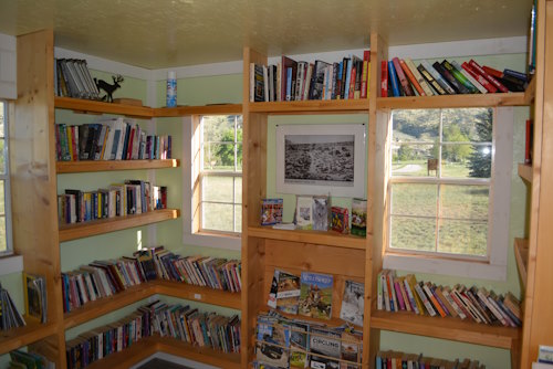
Next to the shower house is one of the cooler amenities at North Fork Campground, a library. The library looks like an oversized garden shed or little house and is clearly a new addition to the park. It’s an attractive little spot and a great idea for a campground.
Inside you’ll find a decent supply of reading material from magazines to kids’ books to novels. There are also DVDs available to borrow if you’re hosting a movie night at the campground.

TROUT CREEK GROUP AREA
The lone group camping area at Buffalo Bill State Park is situated west of the lower campground loop but has its own entrance road (oddly unpaved). It also has its own name, Trout Creek.
The group area is laid out nicely with a u-shaped drive encompassing a central events area. There’s a large, open-walled picnic shelter housing several tables and a wood stove. A fence has been built along its west side as a windbreak. Power is available in the picnic shelter, but nowhere else.
Out front is a communal firepit surrounded by a concrete pad that itself is connected to a web of concrete sidewalks joining all the facilities in this central event area. This includes dual stall vault toilet and a water source. North of the picnic shelter is a mowed lawn with two horseshoe pitches for entertainment.
Camping in the Trout Creek Group Area takes two forms. There’s a handful of angled, back-in campsites on the west side of the area for RVs. To the east is a log-fenced wild grass area for pitching tents. Tents can also be set up pretty much anywhere that there is grass in the group area.
It’s a good group camping area that could be great. Adding some trees would be a huge first step, as Trout Creek is completely barren. I also would have liked it to be a bit more isolated from the main campground loops.
It is, to some degree, but in a teasing way. The long, separate entrance road gives the impression this group area is well away from anything else in North Fork, but it’s pretty close to the lower loop. It would be a fabulous celebration (cough … party … cough) spot if it was more solitary.
Great views, though.


SHEEP MOUNTAIN DAY USE AREA
Somewhat ironically, a template for a perfect group camping area is found at Sheep Mountain Day Use Area. Accessed via Country Road 6Kv, Sheep Mountain is a terrific self-contained day use area across the river from the lower campground loop. It has pretty much everything you’d ever want in a group camping area except the camping spots. Hence, why it’s only a day use area.
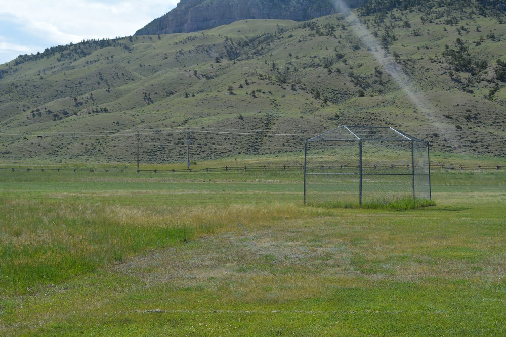
The irrigated postage stamp of lawn is home to the following: picnic shelter, water tap, vault toilet, firepit, grass field, basketball court with hoop, volleyball court with net, baseball diamond with backstop, playground, and fishing in the river. It’s impressive and all irrigated, green, and mowed.
Oh, and it also has trees! The central space with the picnic shelter and playground has many tall, shade-giving trees along the west side of facilities providing all important protection from the sun.
A looping access road comes round to a gravel parking lot. The lot includes an accessible spot connected to concrete sidewalks taking you to the primary facilities. A self-payment kiosk sits at the beginning of the loop.
I swear, if they added some campsites and a tenting area to Sheep Mountain it’d be a fabulous group camping area. Or, I suppose, they could add some of these recreation amenities to Trout Creek and take it to the next level.
Either way, Sheep Mountain Day Use Area is a great spot for a family or friends gathering.



STAGECOACH CAMPGROUND IN BUFFALO BILL STATE PARK
One and a half miles east of Sheep Mountain Day Use, along the south shore of the reservoir, is Stagecoach Campground. Formerly known as South Shore, this is a boat launch that’s recently been upgraded with camping and cabin facilities.
I hope for the sake of everyone’s sanity that this is a work in progress. It’s a barren hellscape with amazing views that, not surprisingly, garnered zero campers when we explored it in early July.
There are no trees. The land between campsites and cabins is au naturel, with ranchland grasses and weeds already threatening to overgrow the facilities. It’s terribly unappealing in my opinion and I’d be hard pressed to ever want to camp here.
Stagecoach Campground consists of 36 unserviced, back-in campsites around an elongated u-shaped loop extending from the original boat launch access road. The sites are flat, gravel rectangles with a movable picnic table and a low-profile firepit. If you ask a dump truck driver to build a campground for minimal cost, this is what you’d get.
At the west end of the loop is a parking lot, also gravel, for cabin parking. There are 8 walk-in cabins with wilderness names like Hawk and Lure. The cabins look beautiful but are small.
Barely larger than a typical garden shed, they have glass fronts and backs providing views of the lake and mountains respectively. Inside is a table and chairs, a wardrobe, and a set of bunk beds. Quite basic, but very nice looking. Lordy, they must get hot inside, though. I hope to hell they don’t end up just rotting away out there.
There is nothing else in the campground aside from a port-a-potty and a pay station at the entrance. That port-a-potty is a terrifying concept. Just sitting out there in the sun, baking. I’d risk an compacted colon before I’d ever step foot in that thing. It makes vault toilets seem appealing and there just so happens to be one.
The original boat launch, which still functions as such, has a vault toilet for use. It’s similar in design to those in North Fork Campground. An accessible parking spot is reserved in front of it which is laughable since there isn’t an inch of concrete to be found anywhere. Bring your offroad wheelchair.
The boat launch is a steep slope into the reservoir with a metal, floating dock beside it. The dock is also described as being accessible. Folks appeared to be fishing from this locale when we strolled past, but I saw no evidence of boats using this facility. Perhaps with the recent flash flooding, they were avoiding the churned, debris laden water.
The one reason a non-boater might approach Stagecoach Campground is to go hiking. The Sheep Mountain Trailhead is found at the intersection to the boat launch and campground. We had no time for a hike, but I’m sure the views are bitchin’.


GIBBS BRIDGE DAY USE AND BOAT LAUNCH
Returning to the north shore of Buffalo Bill Reservoir, Gibbs Bridge is a small picnic area and boat launch. Across Country Road 6Kv from the tent sites in North Fork Campground, it appears to be more boat launch than picnic area.
There’s a large, gravel parking lot with payment system, information board, and vault toilet around its perimeter. A single, accessible concrete picnic spot extends onto the slope behind the vault toilet building. It’s a nice picnic spot, I guess. I don’t recall seeing any others.
During our visit, the recent flooding had definitely impacted this boat launch. It was drowned, for lack of a better term, and left unusable until water levels subsided some. It didn’t look all that well kept either.


EAGLE POINT DAY USE AREA IN BUFFALO BILL STATE PARK
Approximately 4 miles further east from North Fork is the Eagle Point Day Use Area. It’s a modest picnic area with no boat launch, but is more appealing than Gibbs Bridge. It has parking, accessible vault toilet, and three cute, accessible, sheltered picnic spots linked by a trail. There are no trees, so the covered picnic tables are appreciated and the views across the reservoir are quite nice.


LAKE SHORE CAMPGROUND IN BUFFALO BILL STATE PARK

Another mile or so east brings you to the Lake Shore Campground and day use area. The main park office is located here, near the registration kiosk serving both the boat launch and the campground.
Lake Shore Campground is built very much like North Fork Campground but is comprised of three individual loops each situated on a rounded prominence into the lake. Combined, the loops offer 32 campsites and 5 walk-in tent sites.
Sites 1 through 7 in the first loop have power and water. Sites in the second loop, 8 through 18 have power only, and the remaining sites in the third loop are unserviced. Most are pullouts, but a couple back-in sites exist.
Everything is paved. There are vault toilets and water spigots in each loop. One of the loops has a campground host. They also sell firewood by donation. And some of the sites have unparalleled views over the water. Were the campground not so close to the highway, these would be fantastic campsites.


At the west end of the complex, you’ll find the modern boat launch and day use area. If you’re planning a boat excursion or desperate for a nice picnic, this is the place to go as it is far superior to anything else in the park for either pastime.
Winding down a paved road from the highway to the shore, Lake Shore Day Use has plentiful asphalt parking for boats and vehicles, accessible vault toilets, a broad concrete boat launch with long, floating dock, fish cleaning station, and three more cute, sheltered picnic spots, this time with some trees. No, it doesn’t have all the recreation facilities that Sheep Mountain does, but it’s superior to the other two boat launches.


MY CONCLUSION ABOUT BUFFALO BILL STATE PARK
Buffalo Bill State Park is a complicated place to rate. As a whole, it’s a good park with lots of individual places to camp, picnic, and boat/fish. Some of those places are very nice. Others, not so much. What is clear, though, is that money is being invested in the park and it continues to improve. That’s great.
Our experience with the park was exclusively at North Fork Campground. I’ll give that campground 4.33 Baby Dill Pickles out of 5. It’s a very nice campground with all the things necessary for a lovely overnight stay or a lengthier holiday. The vault toilets were smelly, the backwards campsite nonsense is annoying, and the new strip of campsites is ugly, but otherwise, a very good campground.
Lake Shore Campground looked quite nice, but it lacks the flush toilets and showers that North Fork campground boasts. I’d rate it a little less than 4 for this, plus it doesn’t have a playground. It does, however, have a great boat launch and day use area nearby and the views across the lake are superior, so I can’t punish it too much.
Stagecoach Campground … yikes. I would not camp there if you paid me. Way too open and unserviced for my tastes. Those cabins look pretty but are still just boxes in the baking sun. I also saw no evidence of the other campgrounds being full thus forcing someone to use Stagecoach as overflow. I’d give it a sub 3 rating. Maybe even sub 2. Sorry, the place just made me cringe.
Ultimately, though, for a last-minute panic booking when our original plans collapsed, Buffalo Bill State Park admirably served our needs. That alone earns it 4 Baby Dill Pickles out of 5. Knowing it exists and the entertainment available in nearby Cody, I’d happily recommend using this park as a staging area for a Wyoming/Yellowstone vacation, particularly if you’re arriving from then east. Not bad for a last call hail Mary.


