
We returned to the Slocan Valley in the summer of 2025, armed with a fresh list of potential abandoned mine and tailings piles to explore. Our first visit two years prior had ended in disappointment when most of the historical mines we attempted to visit proved inaccessible. Rookie mistake.
This time we were determined to explore something, anything, so we built a list of targets that appeared much easier to access. No multi-kilometre treks along forestry roads that had been deactivated, a fact we’d learned the hard way.
Number one on our list looked easy enough. Readily visible on satellite imagery and just a couple kilometres from town, what could go wrong? Well, I can answer that … sternly worded No Trespassing signs and security cameras could go wrong. Someone doesn’t like the curious.
To say we were disappointed would be an understatement. My son was particularly disheartened. But after some necessary cussing and a few moments to regroup, good ole dad pulled a little miracle out of Google and saved the day.
We made our way back to the highway and headed north to New Denver, conveniently on the way to our campsite in Rosebery. There we would hike to the Molly Hughes Mine ruins on the eastern shore of Slocan Lake. And this time, finally, we got to our destination.
Bigelow Bay Regional Park and the Trailhead
The trailhead for the hike to Molley Hughes Mine is found at the north end of the parking lot for Bigelow Bay Regional Park in New Denver. The village of New Denver is located on the east shore of Slocan Lake straddling the mouth of Carpenter Creek. Highways 6 and 31A intersect in the towns core.
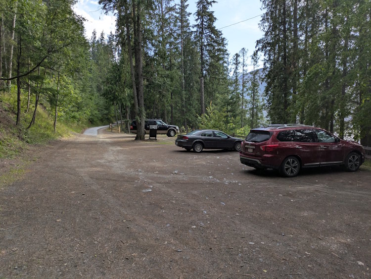
Bigelow Bay Regional Park hides in a treed enclave in the village’s northwest corner at the terminus of 11th Avenue. And I do mean hides. The access road that extends from 11th Avenue looks more like a paved bike trail than something for vehicles. Being unfamiliar with the place, I was reluctant to even drive on it.
But road it is, despite the odd half-asphalt/half-gravel configuration. Descending the modest slope, it takes you to a gravel parking lot with room for perhaps ten cars.
Bigelow Bay Beach
Before heading out on our hike, we took a few minutes to explore the beach and amenities of the park. The trailhead is definitely secondary to this local recreational destination.
The parking lot sits above the beach requiring a jaunt down the hillside. You can beeline it if you’re impatient or choose to follow a meandering trail.
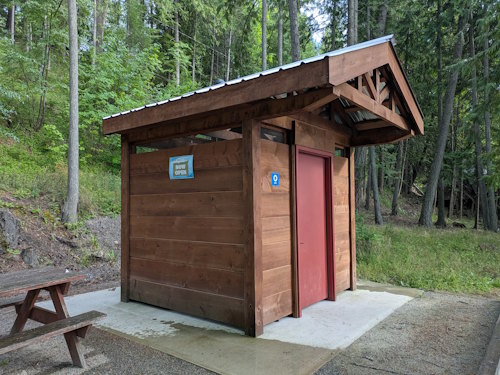
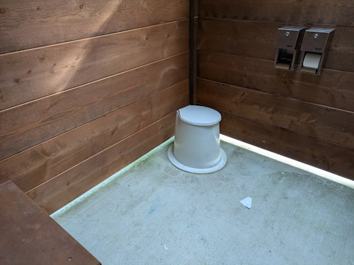
Along the way you’ll pass a newly constructed pit toilet. This is a big, modern facility with plenty of space for those requiring accessibility or as a changeroom. There’s also a picnic table next to the pit toilet which is, umm, an odd location.
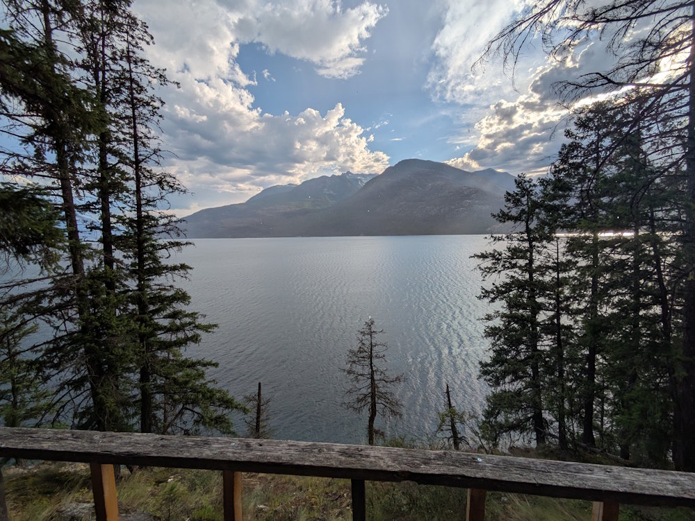
Below the pit toilet is a viewing platform, also new. The park bench situated here provides a lovely view of the beach and Slocan Lake to the north.
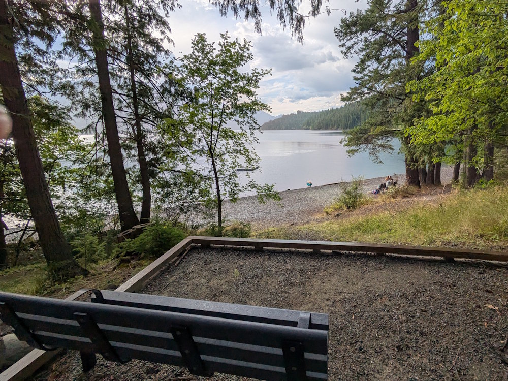
The beach is stony and rims the lake for maybe 100m or so. I’m not good with estimates like this. It’s a decent size for its location, let’s put it that way. And good width too.
Undoubtedly a popular spot for locals, the water is clear and weed-free at the shore. I doubt the water ever gets warm, but swimming nonetheless happens as evidenced by the floating dock with ladder out aways from the shore.
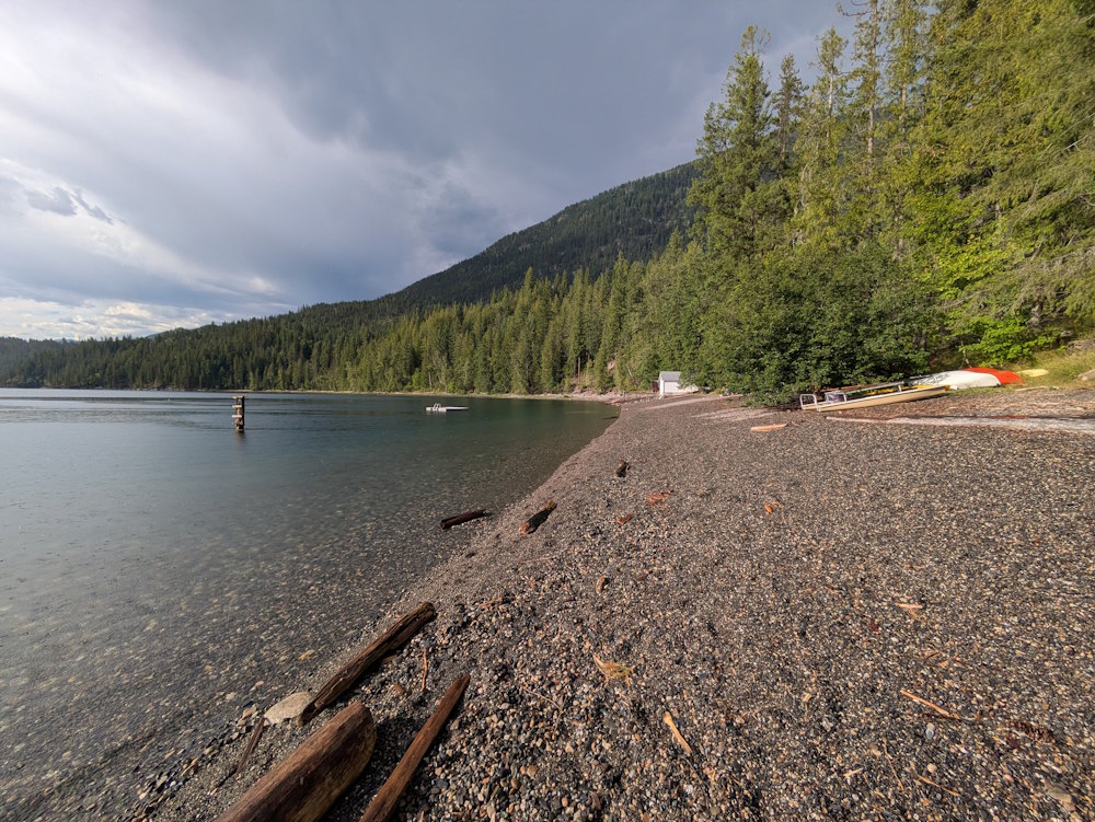
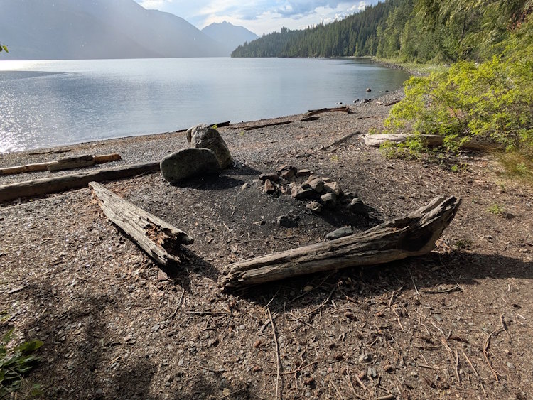
A deeper segment of the beach hosts driftwood and boulders around a pile of ashes and stones indicating that beach bonfires occur here. No idea how “legal” this is but it looks like it would be fun with a group of friends.
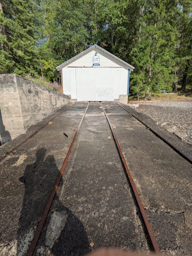
One final curiosity stands at the far end of the beach. It’s a simple, white structure with a long, sloping concrete launch running down to the water. Within the concrete are two sets of railway tracks. I’ve never seen such a building, but the internet tells me it is a BC Parks boathouse.
Molly Hughes Mine Trail
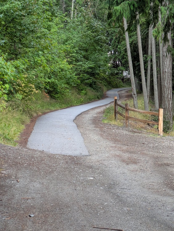
Okay, now for the hike itself. Getting to the Molly Hughes Mine is a roughly 850m hike. That’s just my estimate using Google maps. You won’t find it on AllTrails and I couldn’t find maps of it anywhere else. But it does exist. Honest.
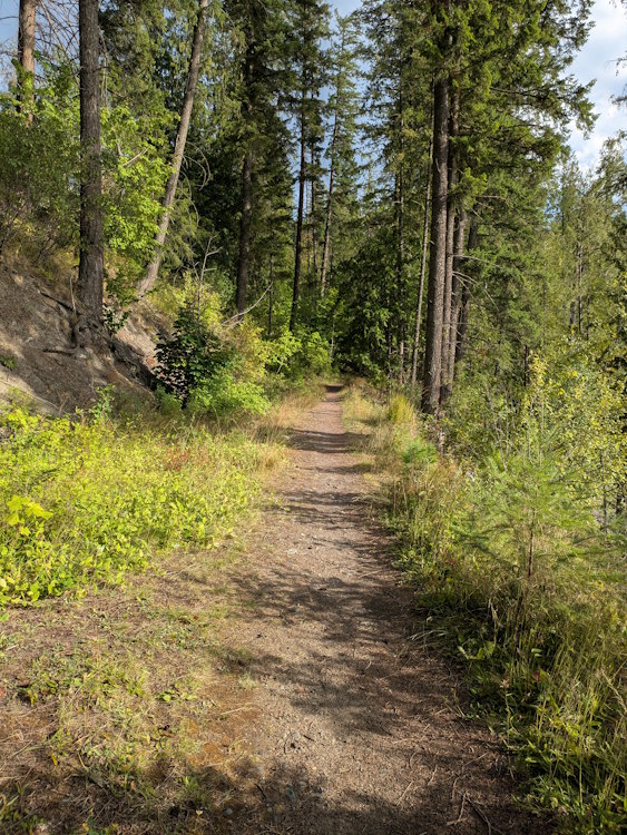
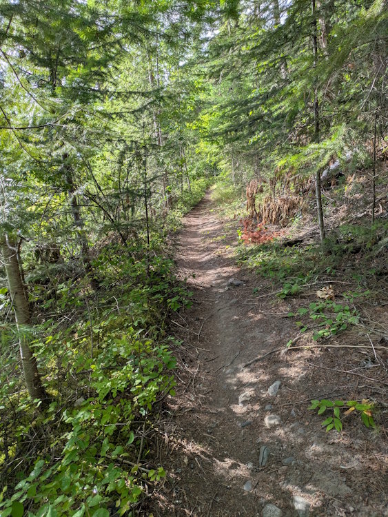
This is a genuine forest trail. It’s trodden dirt with rocks and roots requiring accommodation. It meanders, rises, and falls as it makes its way through the woods. You’ll want proper footwear on this one.
Ironically, the larger Galena Trail runs nearly parallel but further up the hillside. That trail follows a former railway route and is presumably wider and flatter. But what fun is that?
The earliest segment of the Molly Hughes Mine Trail is wider with some exposure to the sun, but it soon gets narrower with trees encroaching. At some points it gets downright rustic as it crosses rivulets via tiny wooden bridges and such. I don’t know, I just find this kind of hiking more stimulating than on flat and wide trails.
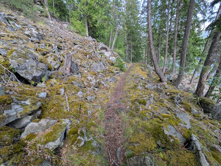
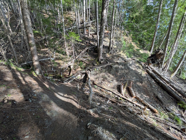
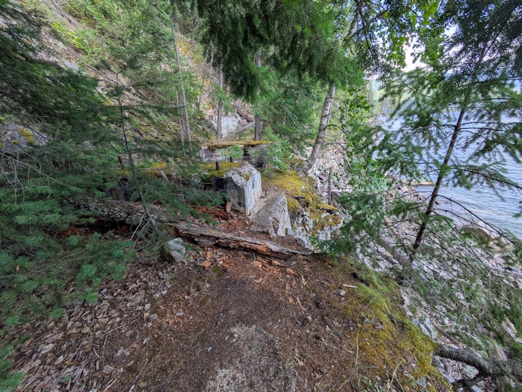
As you near the mine, the trail begins passing through obvious tailings piles. These stretch way up the hillside and tumble down below the trail. So much mining went on in this valley, but you rarely notice it when just driving through.
You’ll pass the odd abandoned adit cut into the rock. The one we saw was small and partially blocked. I don’t recommend entering any of them, but this one didn’t look like it had much to see inside anyway.
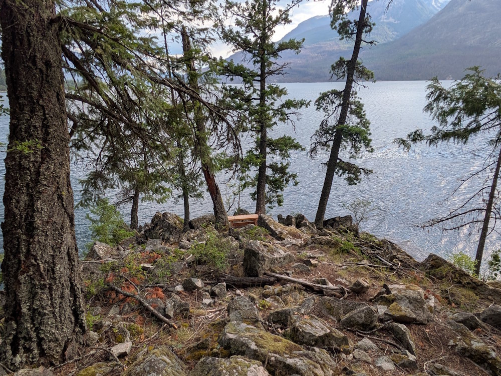
At one point we noticed a small, newish looking bench set on a prominence of rock overlooking Slocan Lake. Someone obviously appreciates a beautiful view. We were more interested in getting to the mine ruins, but if you live nearby and do this hike regularly what a great spot for some introspection.
The Old Cabin near Molly Hughes Mine
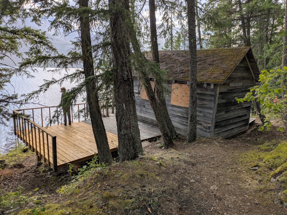
Prior to getting to Molly Hughes Mine you pass an old cabin. I don’t know the story behind this cabin, but we spent a couple minutes checking it out if for no reason other than the view was delightful.
It’s undoubtedly old judging by the weathering, but there is also a newly rebuilt section of decking. The boarding in the windows also looks new. So, someone is paying attention to it.
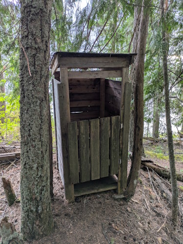
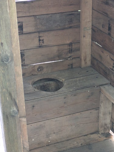
Beside the cabin is a vintage outhouse which is fun. Not for use, obviously, but for contemplation of life before indoor plumbing. And a picture of someone inside with their head visible is always good for the post-trip slideshow.
Molly Hughes Mine
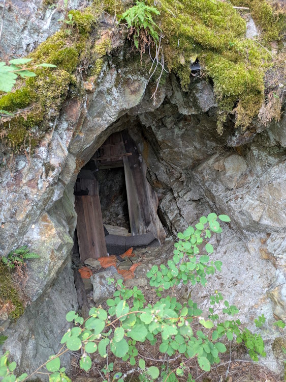
Putting the cabin in the rearview mirror, it’s time to get to Molly Hughes Mine itself. The mine is positioned closer to the lake, so you won’t pass it directly on the main trail. Instead, you’ll take a dirt side trail down the slope to the mine and surrounding ruins.
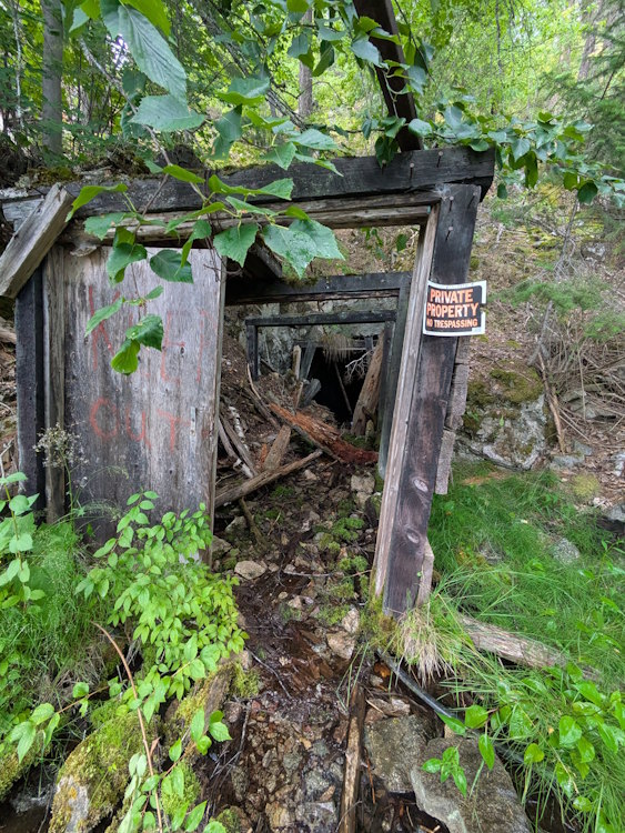
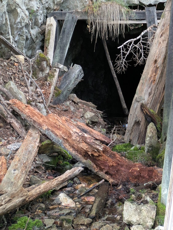
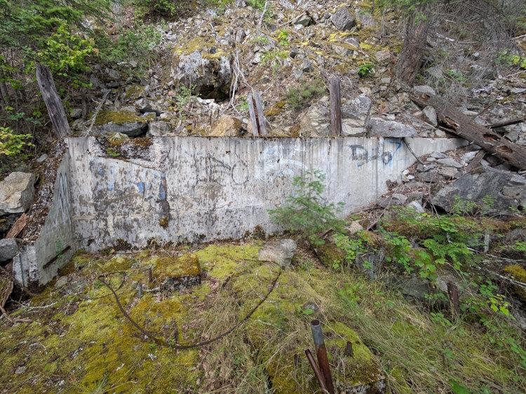
The main mine entrance is quite dilapidated and, apparently, private property. Not that going inside is wise considering the inherent dangers with doing such things. For starters, the water flowing out of the adit suggests it’s messy, if not flooded. Also, a warning sign advising of toxic gases inside the mine further emphasizes the danger. Also makes for a mischievous way to spook mom back home.
Concrete ruins remain in the area as well. Nothing terribly notable about them but they still add to the experience.
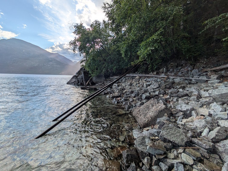
Below the mine entrance, tailings and rubble spill into the lake. There’s also bent rail track that runs out and into the water. If you’re a rockhound, be sure to dig around as there’s some cool chunks of quartz vein still present in these tailings.
Having finally succeeded in visiting a bona fide mine ruin, we were reluctant to leave. We spent a good amount of time exploring the tailings looking for interesting rocks. Found a few but nothing that appeared to be genuine silver/lead ore. Eventually, we made our way back to the car grinning the whole way.
I had a great time on this relatively modest trail. It’s not too long but has plenty of variety along its route. Finding it in a pinch certainly added to the experience. Always nice to be hero dad. If you find yourself in the New Denver area, be sure to check it out.