
On our first visit to Slocan, we discovered a creamy secret. Mountain Valley Station, the unassuming local gas station, bottle depot, courier depot, U-Haul depot, and convenience store serves ice cream. And not just any ice cream. They serve the biggest ice cream cones I’ve ever seen in my life.
Seriously. They even warned us when we ordered a double scoop, giving us a moment to reconsider. I though they were being silly, but when the behemoth was passed to me, I understood. Amazing ice cream cones.
So, when we returned to Slocan a couple summers later, ice cream was on the top of our to do list, but with a caveat. Now knowing what lay in store, we endeavoured to burn some calories before indulging our sweet tooths. That’s where the Old Slocan Highway Trail comes into play.
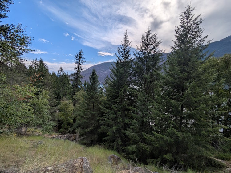
Since 1941, Highway 6 has been the main vehicle route through the Slocan Valley. It follows the east side of Slocan Lake but up the mountainside some. In fact, for about 15km south of Silverton, the highway is inland enough you can’t even see the lake.
Prior to that, the Old Slocan Highway (it probably wasn’t called ‘old’ back then and was likely just considered a ‘road’) immediately north of the village hugged the shoreline for a few kilometres before rising to where Highway 6 now runs.
While undoubtedly scenic, and funky (there’s even a short tunnel blasted through the bluffs), the old road was ultimately too narrow and therefore abandoned when the new highway was built. Much like its railroad cousins in these parts, when a traffic right-of-way’s raison d’être is lost, it gets repurposed as a hiking trail.
The Trailhead for the Old Slocan Highway Trail
In the northeast corner of Slocan lies the sprawling 20 acre, lakeside wasteland that was once a massive sawmill. The mill is now all gone with the lands awaiting redevelopment by the town. Slocan Street runs along the east boundary of the property, eventually fading to gravel as it approaches the lake. At it’s terminus you’ll find the trailhead.
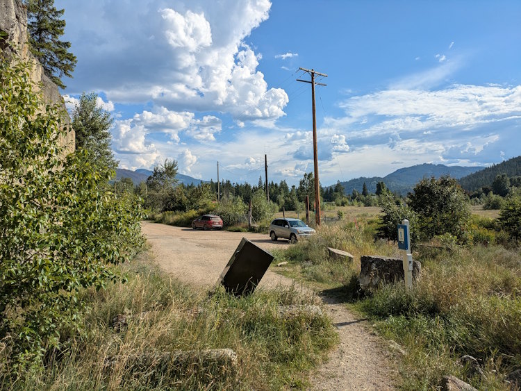
There isn’t much there, to be honest. The road broadens a bit allowing for parallel parking up against property boundary, but I wouldn’t describe this as a proper parking lot. A narrow, dirt trail passes a garbage can and doggie bag dispenser before guiding you to the Old Slocan Highway Trail.
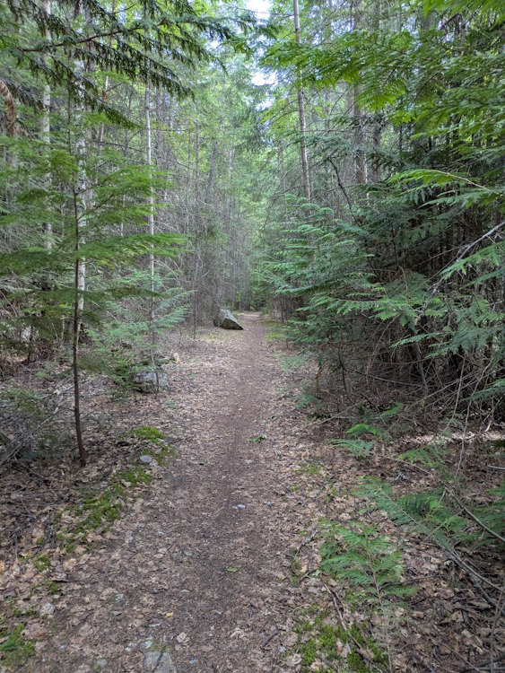
The Early Part of the Trail
At 3.1km long and with tolerable elevation gain (mostly near its end), Old Slocan Highway Trail is easy enough for even the most leisurely of hikers. I’m sure active locals use it regularly to get some exercise strolling beside the lake.
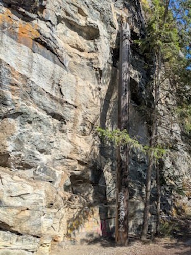
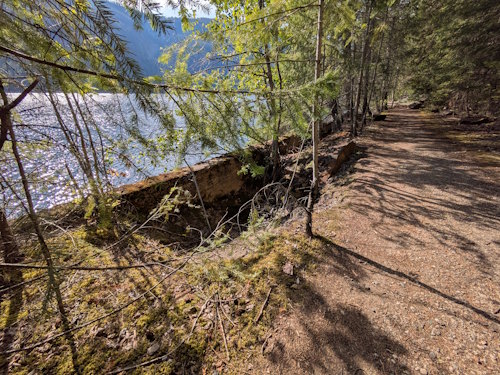
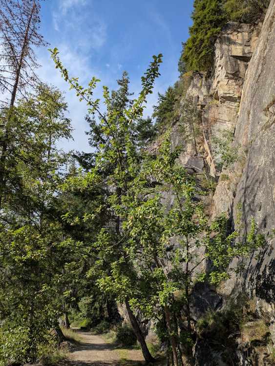
Early on the trail is paved, presumable with remnants of the original highway. Further evidence of its former use is encountered regularly, be it concrete barriers along the lake or old telephone poles clinging to the side of the bluffs.
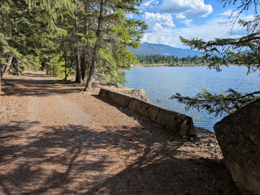
That said, there are sections that had me wondering how two-lane vehicle traffic ever fit between the lake and the cliff face. It must have been a tight fit when vehicles passed each other. Surely, there were a few fender rubs back in the day I reckon.
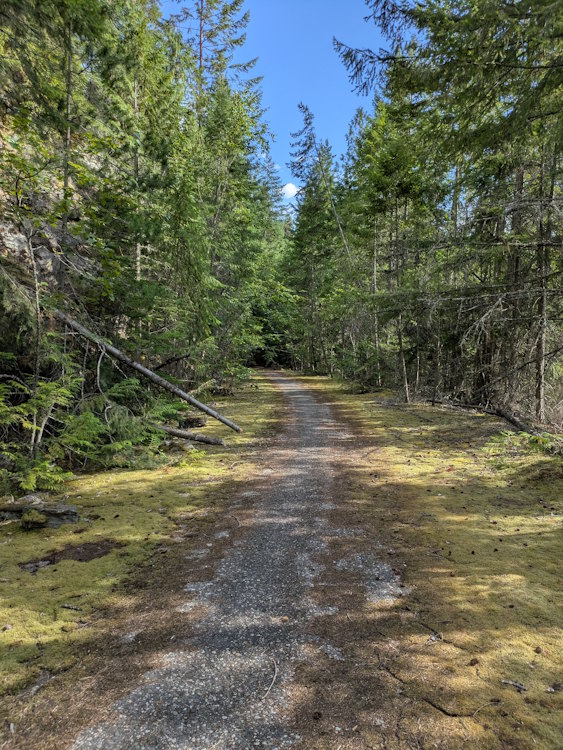
Nature has begun reclaiming its former territory with trees and grasses gaining foothold on both sides of Old Slocan Road Trail. That conifers are leading this effort is no surprise, but a wild apple tree had me do a double take.
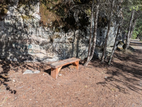
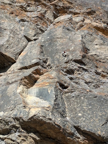
Conversely, modern human influence is also evident, if you consider park benches to be modern. The rock climbing bolt hangers on some of the cliff faces surely are. We didn’t see active climbers during our hike, but it was easy to see the appeal.
The Rock Tunnel
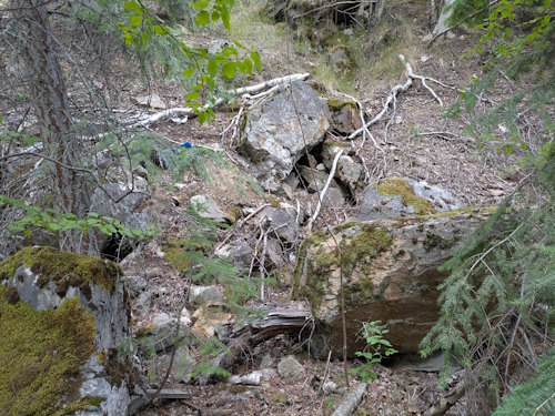
The biggest attraction on the Old Slocan Highway Trail is the former car tunnel. Cut through a prominence of the cliff, the tunnel is not especially long. Even less so now that a section has collapsed.
That collapse occurred at the south end of the tunnel with large boulders now littering the trail that’ll give you pause before entering what remains. Looking up at all the cracks and fissures in the tunnel roof as we passed through gave my heartrate a boost.
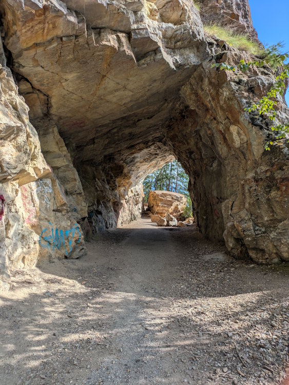
Vehicle traffic through this tunnel must surely have been single lane. It’s just not wide enough for two cars. But for walkers or even cyclists, it’s easy to navigate. Entry rubble, notwithstanding.
The Latter Part of the Trail
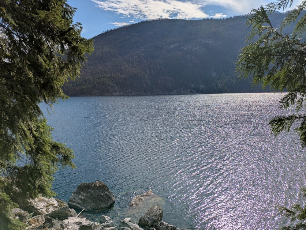
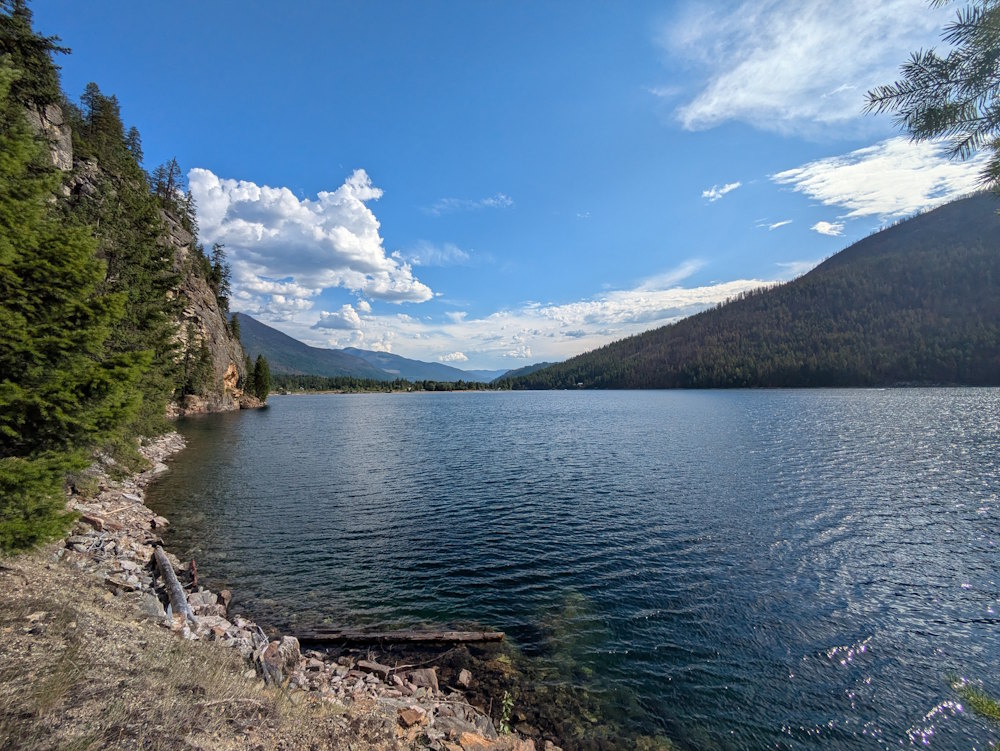
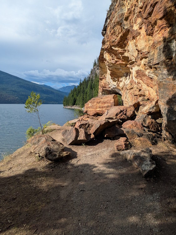
Once you’re through the tunnel, Old Slocan Highway Trail continues to follow the shoreline. You’ll pass a few viewpoints that offer clear sightlines of the lake. In some places you can scramble right down to the water which allows you to look up and down the full lake. It’s quite beautiful.
Other viewpoints have rock promontories jutting into the water. These make great swimming holes where you can jump into the water from decent height and still get back out nearby. I know this because we encountered a couple of young ladies doing just that. And judging by their reaction once they noticed our presence on the trail, they were enjoying this “private” swimming hole sans tops. Sorry … no pictures.
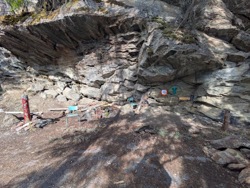
There was one spot, beneath an overhang in the cliff, that appeared to be a hangout of sorts. With graffiti on the walls and some “belongings” strewn around, perhaps young folks blow off some steam here.
The End of Old Slocan Highway Trail
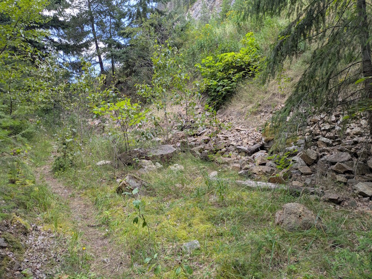
Continuing onward, the trail starts to change. It begins moving away from the water as the bluffs recede inland. The surroundings become more forested reducing the views. It also narrows in parts, becoming dirt though there are portions that retain the asphalt base.
It also starts to noticeably gain elevation. Near its terminus, there is no doubt that you are now close to the existing highway. Piles of garbage dumped from the side of the highway are seen in the rubble next to the trail. And the trail itself eventually turns to a single, foot-trodden dirt path. It’s a rather bland, almost disappointing finale to an otherwise enjoyable trail.
That said, the end wasn’t without a little excitement. As we shuffled along the final couple hundred metres, we spooked a turkey vulture that fled to the treetops overlooking the lake. My phone camera was not good enough to get a proper image of this giant bird, but there was no doubt it was watching us with discontent.
And with that, we turned around to retrace our steps. Another 3.1km of hiking, back the way we came, did wear on me a bit. At 6.2km roundtrip, even an easy trail leaves my hips a tad moody. But that’s nothing a giant ice cream cone couldn’t fix!