I learned something about myself during a Saskatchewan camping trip last summer. I would not have been a good pioneer. Or explorer. Or guide, hunter, or tracker. Why, you ask? Because I … … got lost on a prairie hike.
Now, in my defense the trail is in a partially flooded river valley with ravines and hills and shrubs and stuff. It’s not like I got lost up top on the expansive, endless horizon part. But still, it wasn’t my finest moment.
We were spending the final three nights of a weeklong camping trip at Saskatchewan Landing Provincial Park. This park straddles the western end of Lake Diefenbaker like ribbons on either side of Highway 4 approximately 50km north of Swift Current.
The park is host to three interpretive trails: Ridges and Ravines Trail, Prairie Vista Trail, and Rings Ruts and Remnants Trail. In addition, the Beaver Flat 50 Trails, a suite of trail legs used for an annual endurance challenge, climb up and down the southwest valley wall. I can assure you I have not, nor will I ever, participate in that.
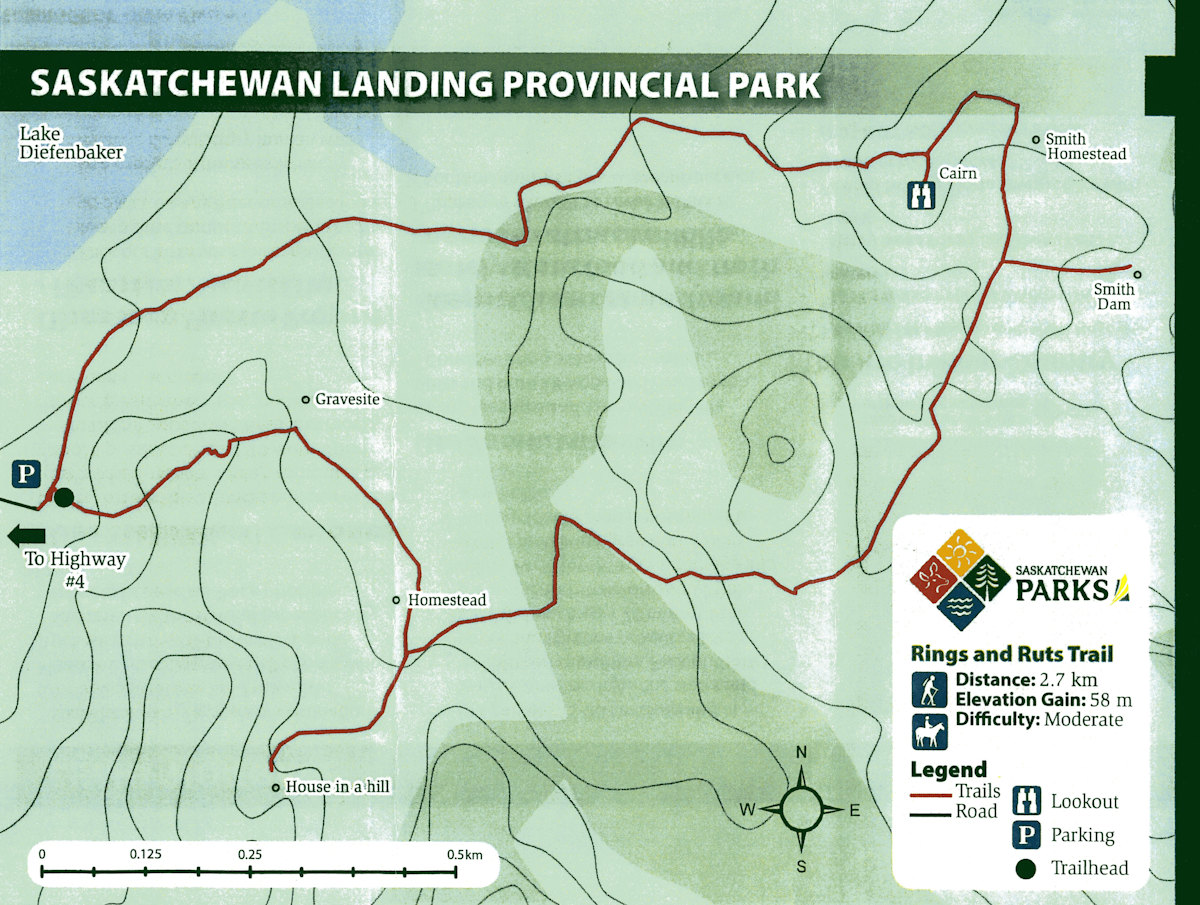
The three of us did fancy a hike, however, and we settled on the Rings Ruts and Remnants Trail for our little adventure. At 2.7km in length, it landed in our Goldilocks zone, not too short (Ridges and Ravines Trail is 1.15km) and not too long (Prairie Vista Trail is 3.5km). Having the most points of interest along its path (six in total) didn’t hurt either.
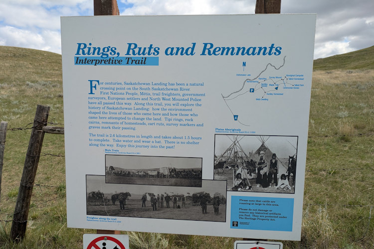
Rings Ruts and Remnants Trailhead
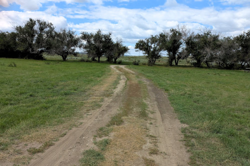
The trailhead is located 870m east of Highway 4. The access road that gets you to the trailhead parking lot intersects Highway 4 opposite the entrance to Goodwin House. It begins as gravel but transitions to a field path that a tractor might use. Our Pathfinder had little difficulty with it and cars can make it as well. With caution. Slow and steady like the tortoise.
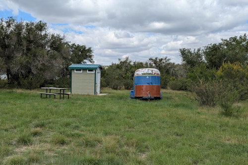
The field path follows the lake’s shoreline before heading inland as it approaches the trailhead parking lot. Just beforehand, it passes an old horse trailer, lone picnic table, and what I thought was a pit toilet. I attempted to look inside, but it was locked up tight and I’m now unsure what it really is.
In fact, all three of these items are a bit of a mystery but ultimately, not important. I suppose you could have a quick picnic before your hike, but I’d recommend, umm, relieving yourself before arriving.
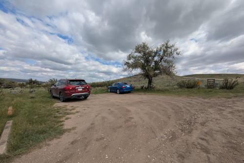
The trailhead itself consists of a modest, gravel parking lot overgrowing with grass and weeds. There’s a single, ratty tree present for a bit of speckled shade for whomever gets there first. Everyone else, like us, will have to leave their vehicles in the sun. Unless you’re fit enough to walk (or cycle) to the trailhead. Keeners!
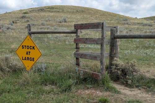
The east side of the parking lot is bound by a wire fence that extends both to the lake and beyond view in the other direction. The trail is on the other side of this fence, as is “stock at large.” This becomes relevant shortly.
An angled opening in the fence allows hikers in while preventing the aforementioned “stock at large” from getting out. Marking an irregular, circular route, Rings Ruts and Remnants Trail loops through the hills and ravines of the southeast valley wall. There are six points of interest along the way, three of which require navigating brief offshoots from the main trail. You can traverse this trail in either direction; we chose counterclockwise.
Burial Ground and House in a Hill
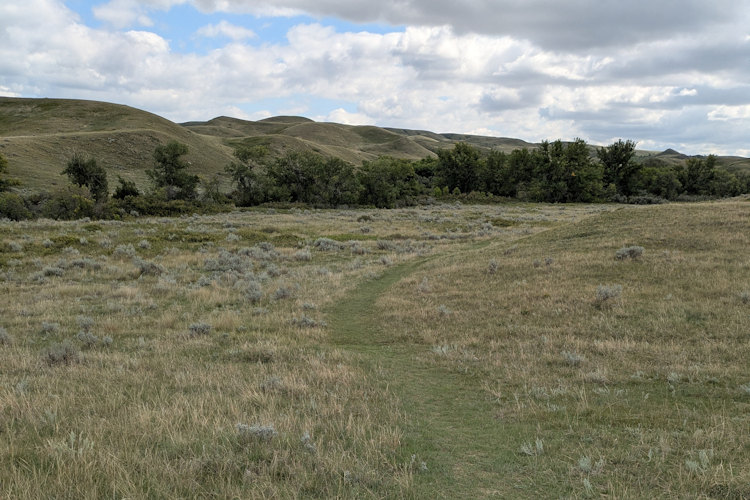
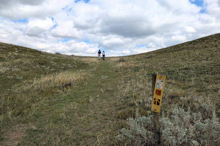
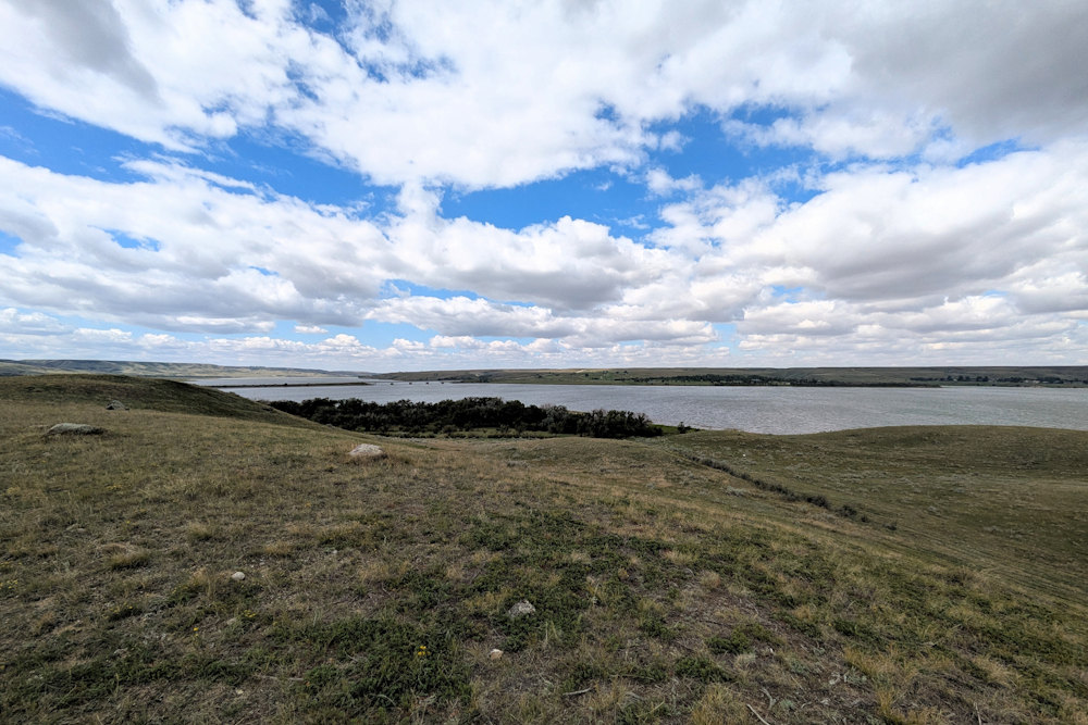
Our hike began smoothly enough. The trail is easy enough to follow as the trodden grass, cut grass, and exposed dirt make it rather intuitive. Trail marker posts and trail signage help as well, at least to start. And with no trees to speak of outside of ravines, any gain in elevation reveals sweeping views in all directions.
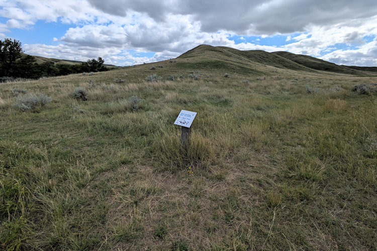
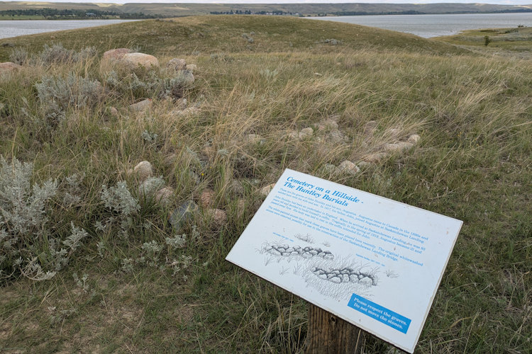
The first point of interest we encountered is the gravesite of two early settlers at Saskatchewan Landing. Consisting of a pair of elongated stone mounds on a slight rise, you wouldn’t necessarily recognize it as such without foreknowledge or the accompanying signage. Always a heavy experience standing over old burials.
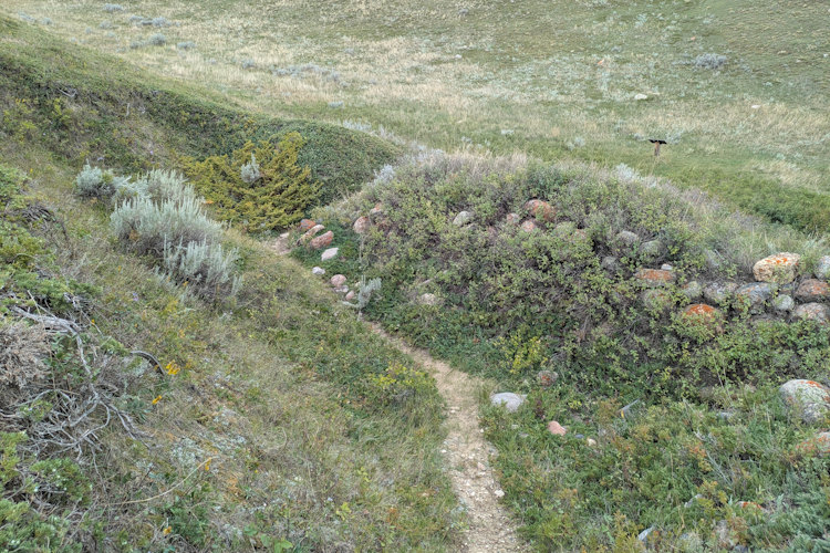
Continuing onward we passed a homestead according to the map. I don’t recall seeing anything at this location but soon after the trail encounters the first offshoot to the right. Following it roughly 200m uphill it brought us to the House in a Hill.
This too is a mostly a pile of rocks though these are accompanied by a readily identifiable depression in the hillside. It’s obvious that the House in a Hill was nothing like what we expect of a house nowadays. Nor was it even like what we perhaps envision a pioneer’s house to be like. This was as basic as human shelter can get, outside of a cave. It’s remarkable to think people once lived in such harsh simplicity all in hope of a better life.
Getting Lost on Rings Ruts and Remnants Trail
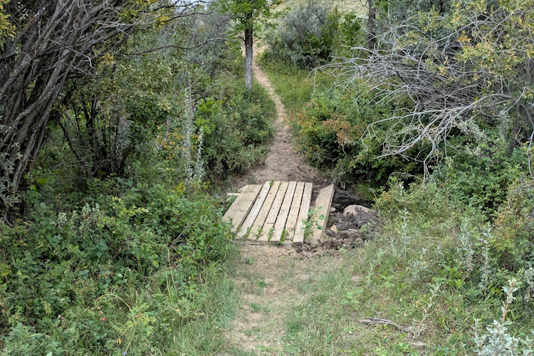
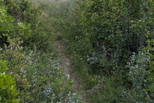
After taking in the hillside abode, we returned to the main Rings Ruts and Remnants Trail to continue our hike, unaware of the embarrassment that was about to befall us. The trail turns to dirt and heads through a wooded ravine. The passage is narrow here as the bushes encroach. At one point it crosses a muddy section that must flow water during rain events and spring melts.
Coming out of the ravine, the trail takes a sharp turn to the right and follows the edge of the bushes. Simple enough. I mean, the beaten down grass is hard to miss and we dutifully followed it. The map told us the next point of interest was Smith Dam, so the fact we eventually ran into actual standing water didn’t strike us as odd.
That the dirt trail struggled to navigate the rim of one such pond became concerning. We tentatively trekked onward for a few more metres before both the trail and our confidence all but disappeared. There was no way we were still on the Rings Ruts and Remnants Trail.
In fact, it was no longer clear we were on a trail of any kind. And we had surely walked far further alongside the ravine than the map indicated we should have. As I look at the map now, it’s bloody ridiculous that we veered off the proper path as far as we did.
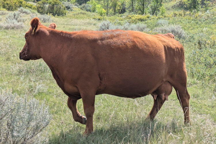
We turned ourselves around and headed back the way we’d come. When we happened upon a bug-covered cow wandering out of the ravine, it became clear where we’d gone wrong. Instead of following the Rings Ruts and Remnants Trail, we had unwittingly followed a popular path of the infamous “stock at large.”
In my defense, and yes, I was the primary navigator that led us astray, the actual trail at the point of our diversion was not as obvious as you might expect. Looking on a satellite image, the entirety of Rings Runts and Remnants Trail is easy to follow and in no way would anyone mistakenly follow the edge of the ravine as far as we did. Yes, the cow path is visible but it’s nothing like the people trail.
At ground level, however, when passing through, the correct fork was not so obvious. That we continued so much further than any sensible person should have, especially someone with a map in hand, is my bad. And my shame. Who knew walking around wide-open space could be so tricky.
Gaining Elevation on Rings Ruts and Remnants Trail
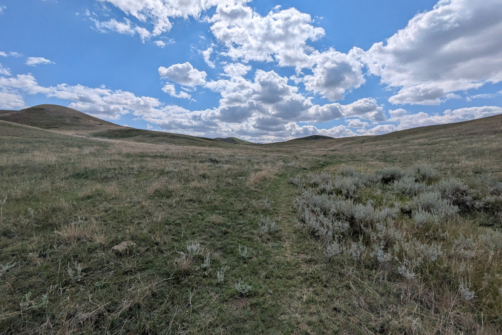
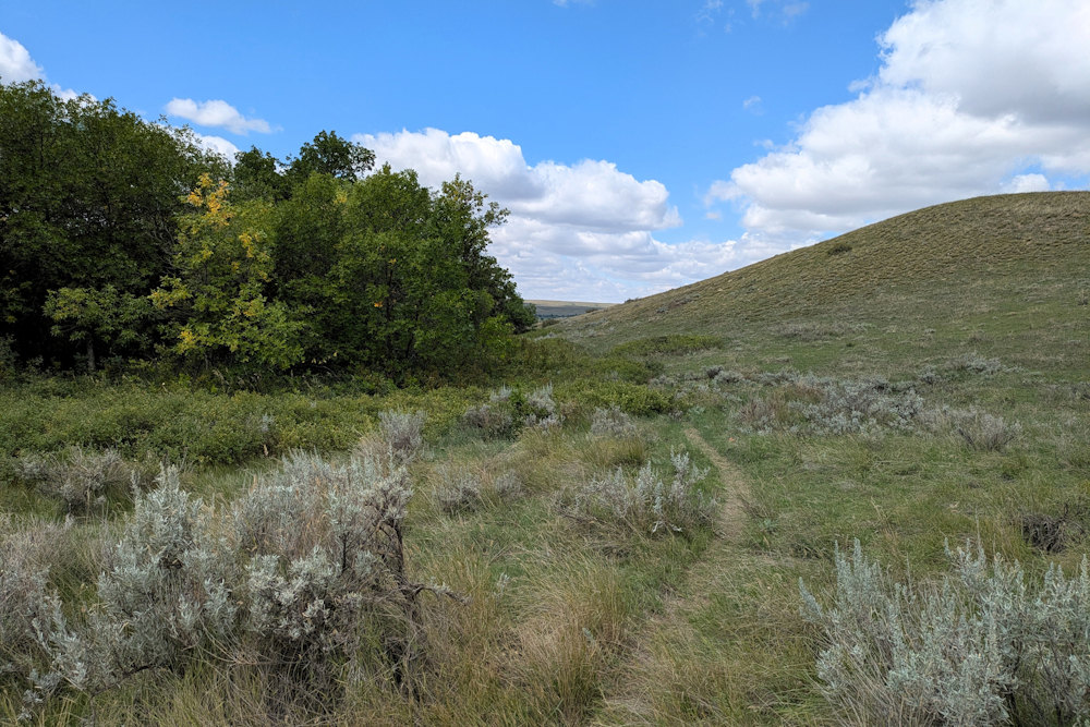
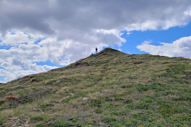
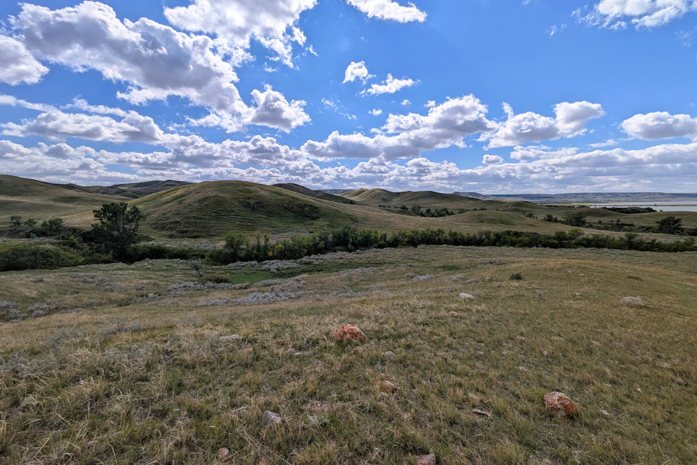
Having reoriented ourselves, we carried on with the remainder of our now longer than 2.7km hike. This required an elevation climb, one greater than you might expect. The prairies may be flat, but rivers cut deep. The resulting “badlands” topography can reveal a surprising range from ravine base to ridge peak.
The best part of gaining elevation is the expanded view. The undulating valley walls, endless grassland with lichen-covered rocks and slashes of shrubs, big sky with marching battalions of clouds … it’s all so very impressive. And humbling. You can’t help but think of the peoples that have called this place home for millennia and those that chose to make it their new home.
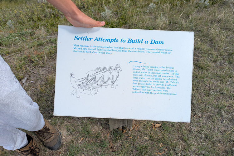
Smith Dam and Smith Homestead
Ironically, the next point of interest on the trail is Smith Dam. After our unfortunate misadventure along the cow trail that did lead us to water, discovering that the Smith Dam is very much lacking in liquids was disappointing. I guess the use of “attempts” on the educational trail signage is key.
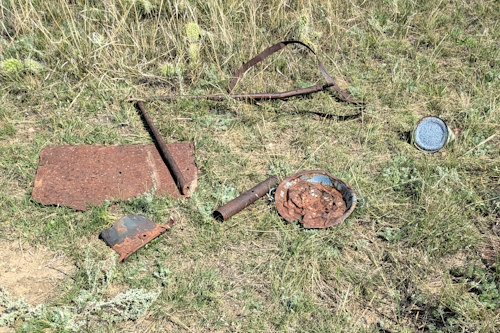
Luckily, Smith Homestead, the next point of interest, had more to see. And not just rocks and hollows in the hillside. Household relics, mostly rusted metal implements and cans, remain which I didn’t expect. Nothing valuable, mind you. That stuff would surely have been pilfered by now. But it’s nonetheless interesting and proof positive of former habitation.
The Return Leg
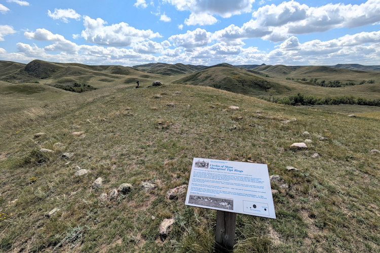
At this point the Rings Ruts and Remnants Trail turns fully back towards the west for the return journey to the trailhead. The final point of interest are some First Nations tipi rings and an old surveying cairn. Back to rocks but still cool.
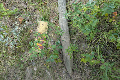
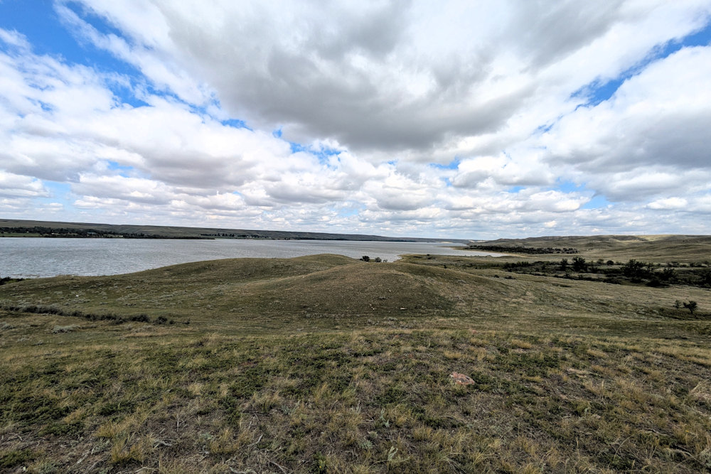
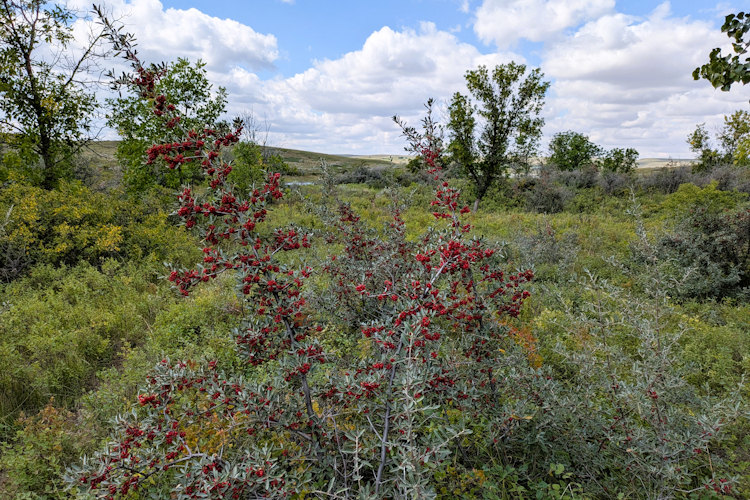
The trail now descends back down towards the lake. You can see up and down the reservoir from this vantage point as well as see the whole north side of the park. Once again, it passes through a ravine overgrown with shrubs and berry bushes. There’s also evidence of damaged, lost trail posts which had me wondering if I’d have gotten us just as lost doing the trail clockwise.
The final leg of the trail follows the fenceline, returning to the entrance gateway. Despite our navigational hiccup, the Rings Ruts and Remnants Trail hike was quite enjoyable. A bit breezy, sure, but a lovely trek on a mostly sunny, summer day.
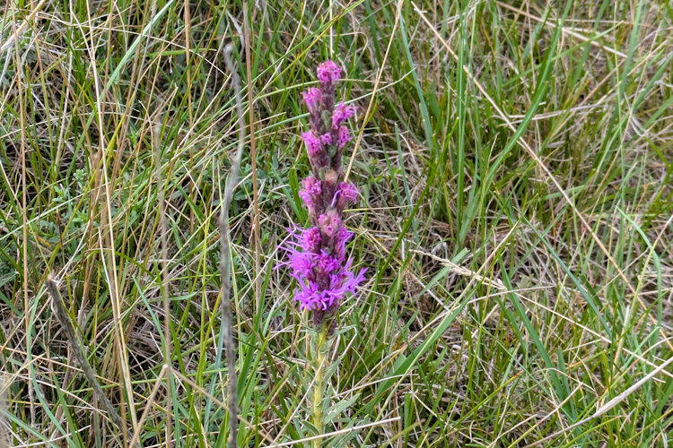
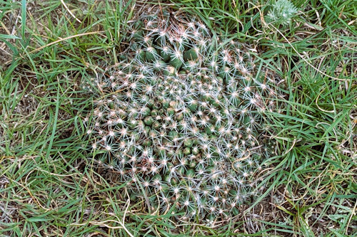
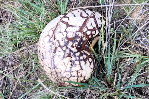
With a little history, wildflowers, cacti, mushrooms, berries, and insects it’s a wonderful way to spend a couple of hours during your Saskatchewan Landing Provincial Park camping trip. Just be wary of the stock at large and the trickery they play on unsuspecting city slickers.
Your last set of photos sold me. We are headed back east through Cypress (SK) and Grasslands east block en route to Lake Winnipeg late summer. Any recommendations with respect to Saskatchewan Landing Provincial Park?
Stay tuned. I’ll be publishing a detailed review of Saskatchewan Landing Provincial Park in a week.