
The Kaslo and Slocan Railway, also known as the K&S Railway, hauled ore, freight, and passengers in various configurations from 1895 to 1914. The 45.4km line connected the lake port village of Kaslo with the silver boomtown of Sandon.
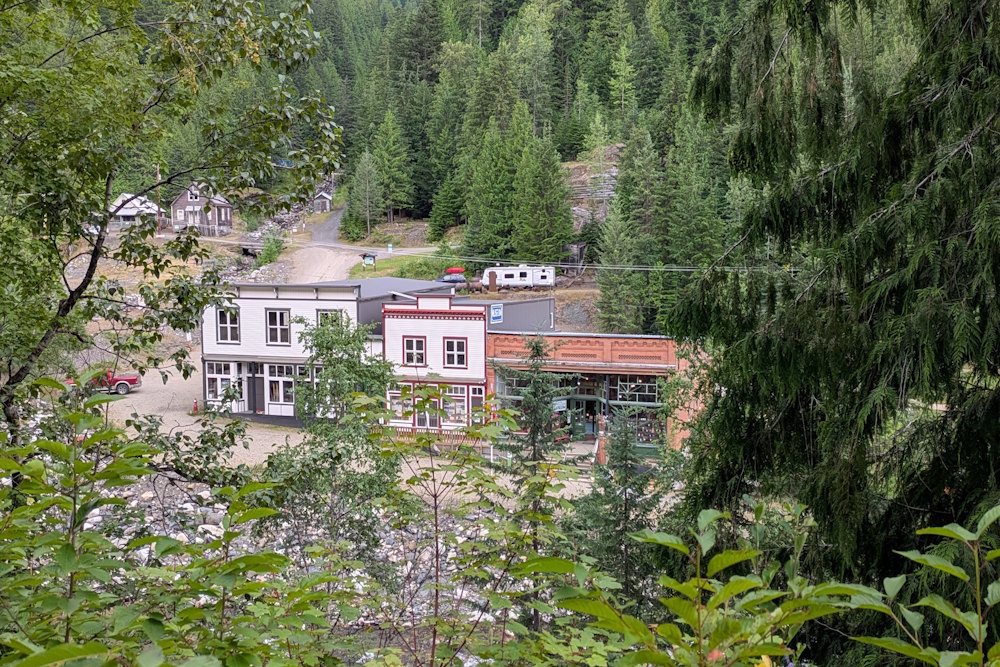
Those glory days are long gone, of course. Kaslo no longer operates as an industrial port, instead surviving as a summer vacation spot and home to the S.S. Moyie sternwheeler historic site. Sandon is a near ghost town and quirky tourist destination. And all that K&S track has been pulled. But, when the march of progress gives you lemons … make lemonade.
In recent decades, a popular recipe for said lemonade has been repurposing former railroads into hiking trails. It’s a great way to build out the trail network across the country, especially in places with colourful mining histories now sustained by tourism.
K&S Railway is one such glass of lemonade, now fittingly known as K&S Historic Rail Trail, sometimes shortened to K&S Rail Trail or K&S Trail. On some websites such as AllTrails, it is identified as Payne’s Bluff (Paynes Bluff), a hat-tip to its endpoint near the intersection of Highway 31A and Sandon Cody Road.
Yes, that’s correct. The entirety of the old K&S Railway has not been turned into lemonade. At least to the best of my knowledge and research ability it hasn’t. But the 12.6km that has been is a quenching glass nonetheless.
K&S Trail as currently configured runs 6.3km from the ghost town of Sandon to Payne’s Bluff overlooking Three Forks. And for the purposes of this review, that’s what we’ll stick to since it’s the part we hiked. Uhh, mostly.
We did not hike the entire distance, choosing to turn back at the Payne Mine Concentrator ruins (~3km one way). Having hiked a portion of Galena Trail in the morning and then exploring Sandon over lunch, doing a full 12.6km out and back hike in the afternoon was beyond my aging-ass ability.
That’s what’s great about these former mine railroad trails. There’s always points of interest along the way that make for ideal turnaround points if the full trail length is too much. I’ll likely regret not seeing the view at Payne’s Bluff but an excuse for a return visit isn’t the worst thing to have.
The Trailheads of K&S Trail
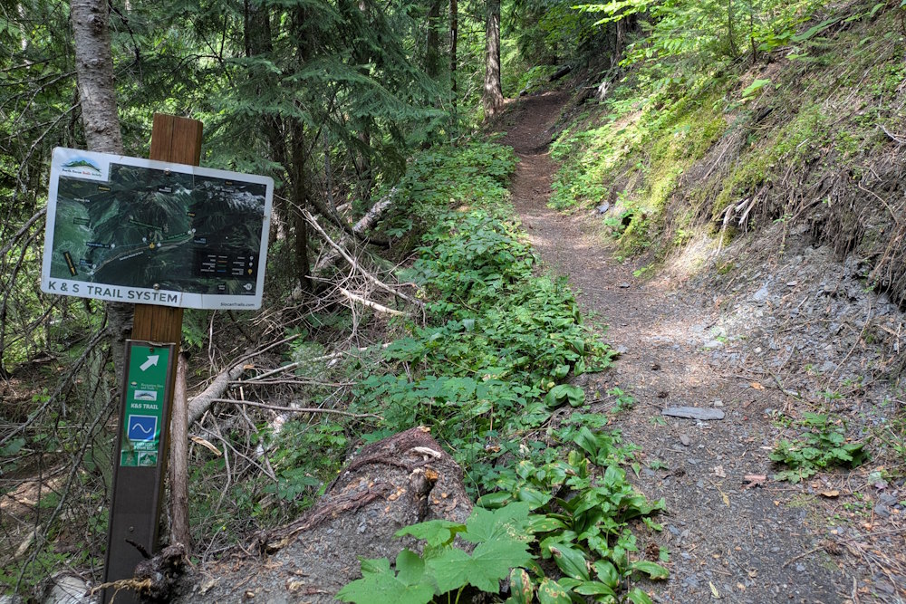
You can access K&S Trail from either end. Approximately 150m north of the Sandon Cody Road turnoff along Highway 31A there’s a modest gravel pullout with a small K&S Trail sign. Beginning here requires an immediate climb up to the bluffs which may or may not rock your boat.
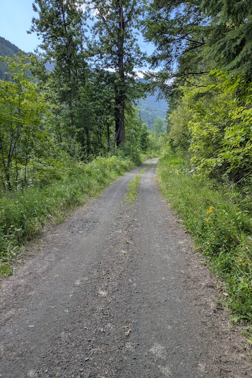
The primary trailhead, however, is located in Sandon. At the far east end of town, across the river from the museum, on the north side of the road, just before a private residence is a turnoff to a narrow forestry road. A large, wooden sign names the trail and shares historical information about its railroad predecessor. A pullout offers rough parking here.
While this is technically the trailhead, the first 660m of the trail is this forestry road. As such, it is vehicle accessible and you can drive that first section of the trail. We chose to hike from the trailhead, but I will admit to wishing we’d driven the first bit during our return.
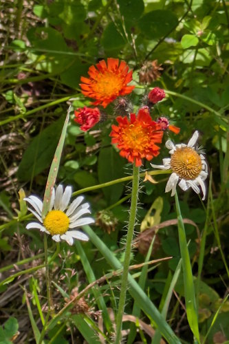
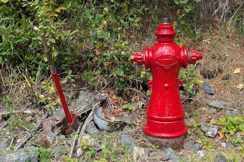
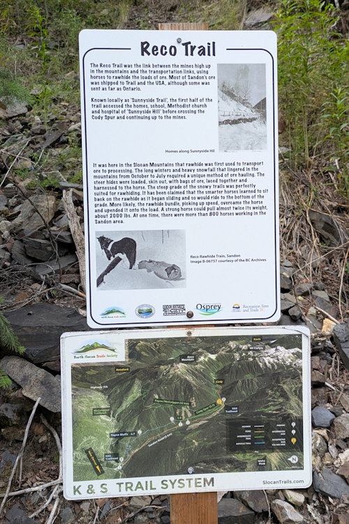
A forestry road may not sound like the nicest hike, but there are wildflowers early on that I found appealing. We also passed an interesting fire hydrant which I assume is a relic of early Sandon? And signs revealing historical information about trails and former settlements in the area add an educational flavour of the hike.
The K&S Trail Outhouse
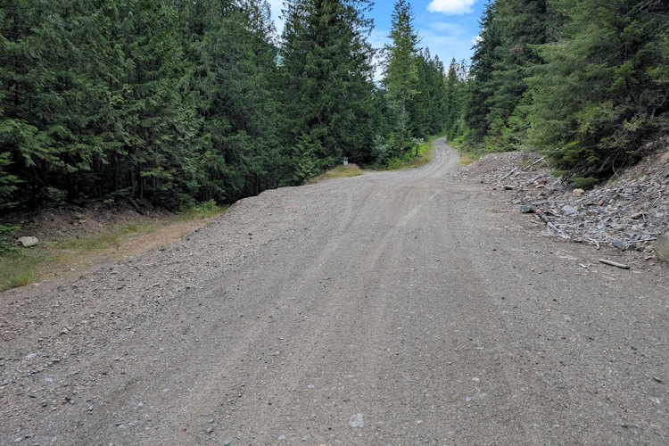
At that 660m mark, the road broadens to a degree. I wouldn’t call this a parking lot but there is room to park vehicles off to the side. The forestry road continues onward to the right while the trail diverges to the left, into the woods.
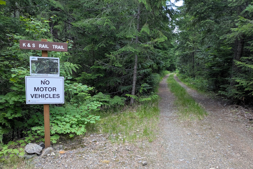
You’ll encounter small K&S Rail Trail sign and map at this secondary trailhead. The trail is still wide enough for vehicles with two, parallel paths separated by grass, however, they are forbidden from this point forward.
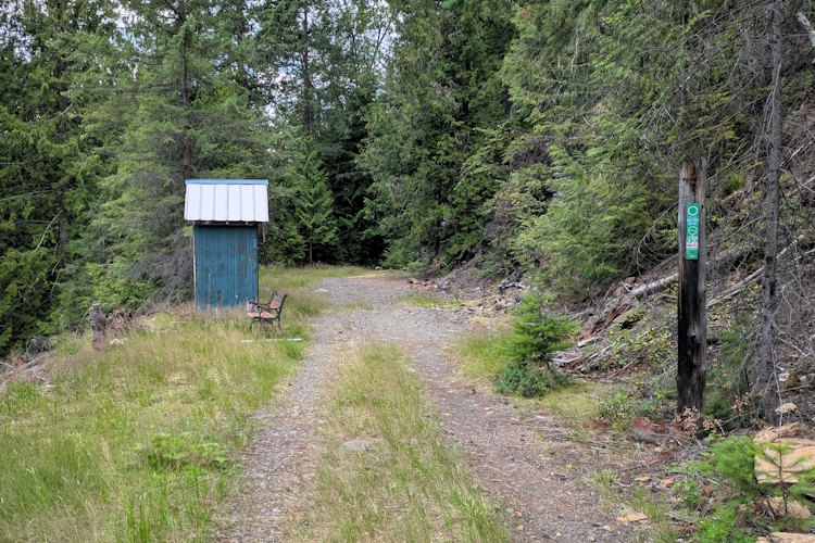
This bush road segment (my terminology) eventually passes a trailside outhouse in a small clearing. There’s even a park bench here should you want a moment to sit and collect your courage before entering the outhouse. I certainly did not.
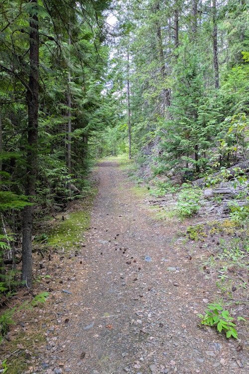
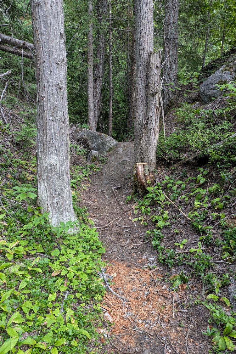
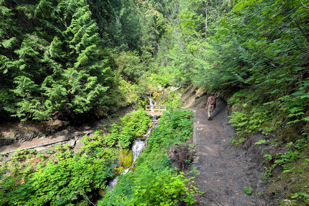
Continuing onward the trail narrows to a more traditional configuration. Still wide enough for side-by-side hiking or mountain bikes, but no longer a “road”. It also continues to be very flat as one would expect of a former railbed. Great hiking for those disinterested in or unable to endure elevation changes.
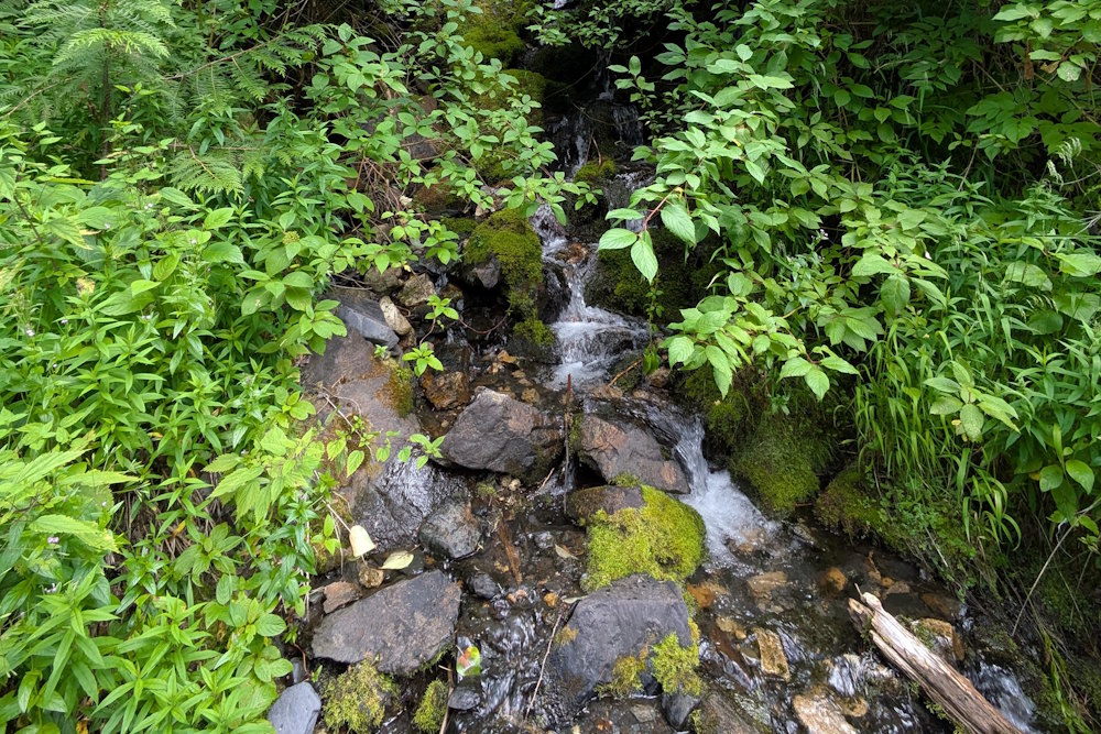
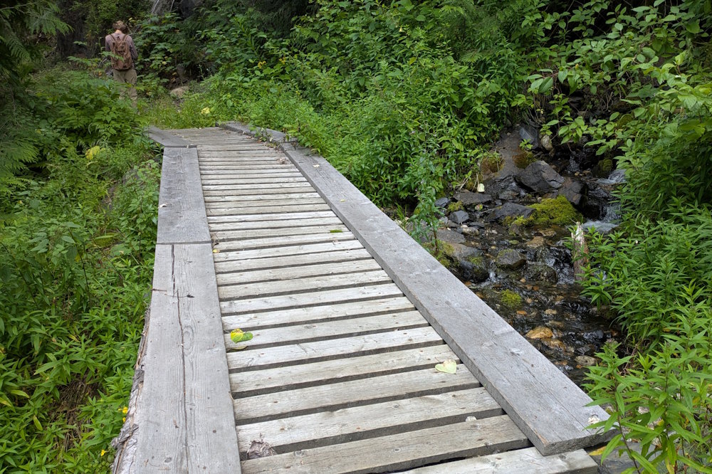
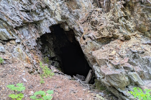
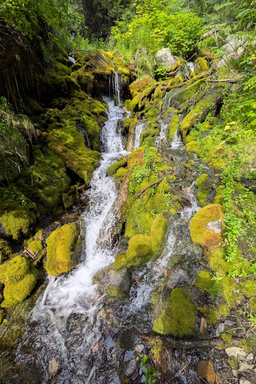
Little points of interest start to grab your attention. Rivulets cascading down the mountainside passing beneath sections of boardwalk. Dark, abandoned adits cut into outcrops. They’re lovely little distractions from the somewhat monotonous nature of a flat trail through the woods.
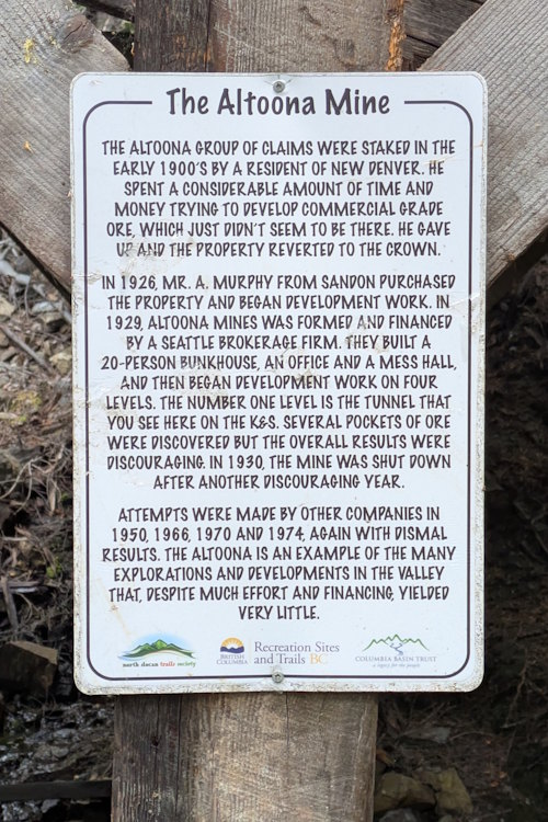
Altoona Mine Ruins on the K&S Trail
Finally, the first attraction on the K&S Trail is reached: Altoona Mine. Originally staked in 1900, the Altoona mine is a notable failure in the Silvery Slocan silver rush. Multiple attempts in the 20s, 50s, 60s, and 70s all failed to find or produce economic ore.
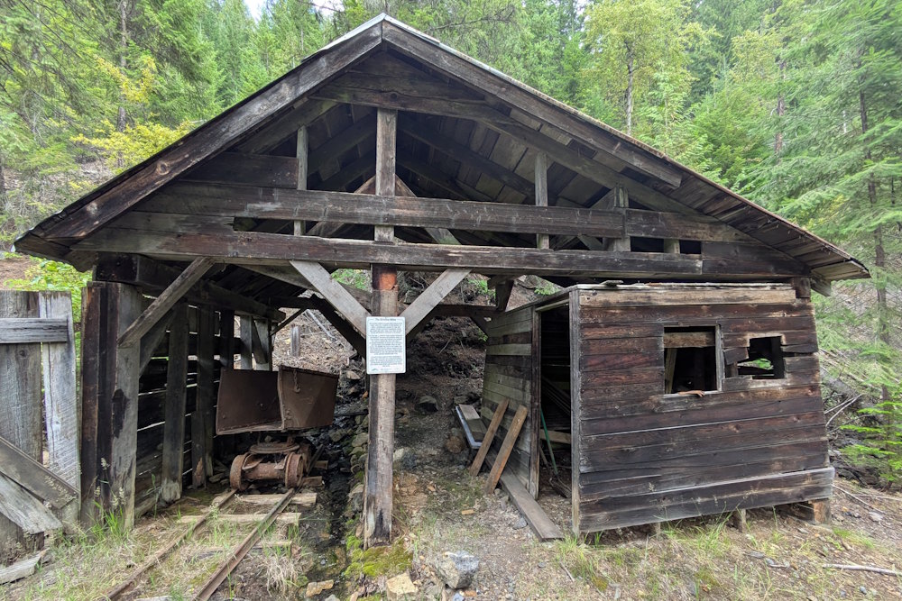
What remains is this dilapidated structure accessing the level one tunnel. The attached core shack still has core cases inside and scattered small pieces of core on the ground, but these have long been picked over so don’t expect to find much of interest.
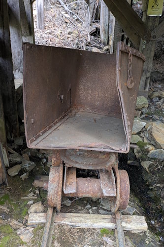
An old minecart remains, abandoned on a set of narrow-gauge rails that exits the tunnel, crosses the trail, and finally overhangs the downslope. Tailings are found both below and above the mine and are fun to rummage through but again, don’t expect to find much in the way of ore. The mine was a failure, after all. They didn’t accidentally leave chunks of galena
behind.
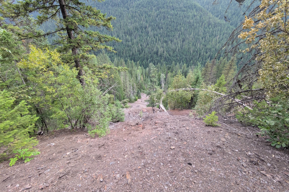
Moving on from Altoona, the trail further narrows into a genuine forest trail. Presumably leaving the former railway right-of-way, the single-file dirt path weaves between trees and undulates with the terrain. This is the most enjoyable portion of the trail in my mind, being more adventurous than the flat, wide early stages.
You eventually come upon a more substantial rivulet tumbling down the rockface between patches of green moss. The trail makes a hairpin turn here with a small bridge crossing the water. It’s very beautiful. And the change in air temperature in front of that waterfall is remarkable … and refreshing.
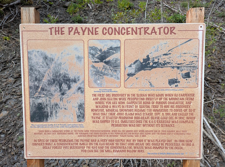
The Payne Concentrator on the K&S Trail
Coming out of this little natural wonder, you’re now not to far from the ruins of the Payne Concentrator. Sadly, there’s not much here to look at. No standing structures remain with only some scrap metal and large timbers revealing that anything industrial was ever here. Well, that and long river of tailings tumbling down the hill almost as far as you can see.
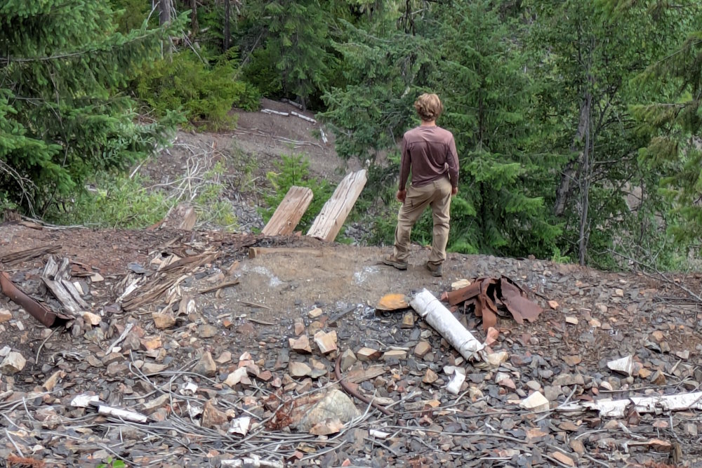
I found it all a little disappointing, to be honest. It’s just more fun to find tangible ruins to explore. Like those at Alamo Siding on Galena Trail, for example. But, hey, the vista from this vantage point made up for any relic shortcomings.
This was the final destination for our hike on the K&S Trail. We spent some time exploring the ruins before turning around and heading back the way we came. What lies between the concentrator and Payne’s Bluff is unknown to me and will remain so, possibly for some time.
I quite enjoyed our time on the K&S Rail Trail despite being pretty bagged before we even started. We just did too much in one day and with this being the final event on our itinerary, it was bound to suffer from my exhaustion. With fresh legs and mind, I’m sure I’d have savoured it more fittingly.
Nonetheless, I have no reservations in recommending this hike. Doing the full length is presumably quite rewarding but even a shortened adventure like ours is well worth doing. Coupling this hike with an hour or two discovering Sandon makes for a perfect day trip in the beautiful Slocan Valley of British Columbia.