Canadian history has a knack for occurring in the middle of nowhere. This is particularly true of New World colonial history which is, to be fair, not all that surprising. In some cases, however, like the Fort Walsh National Historic Site, that history remains in the middle of nowhere.
Okay, that’s a little hyperbolic and unfair to everyone’s favourite prairie province. Especially, if you take into consideration Canada’s far north which has myriad really in the middle of nowhere places. But there’s no denying that southwest Saskatchewan is sparsely populated and a ways away from urban centres.
Why is Fort Walsh Notable?
For those of you who’ve forgotten your high school history, Fort Walsh was built in 1875 by the North-West Mounted Police (NWMP). The NWMP was created, in part, as a response to the 1873 Cypress Hills Massacre which saw up to 30 Nakoda First Nations people murdered by American wolf hunters.
Fort Walsh served as the force’s headquarters from 1878 until 1882 before being dismantled in 1883. The NWMP would, of course, evolve into the iconic Royal Canadian Mounted Police (RCMP). Portions of the fort were rebuilt in 1942 as Remount Ranch, home of the RCMP’s horse breeding and training program until 1966. Parks Canada would take over the site in 1968.
Where is Fort Walsh National Historic Site Located?
Located at the southeast end of the West Block of Cypress Hills Interprovincial Park, Fort Walsh is 55km southwest of Maple Creek, Saskatchewan. It’s also 118km or 148km from Medicine Hat, depending on your chosen route, and 192km from Swift Current. Like I said, it’s a ways away.
Getting to Fort Walsh
The easiest way to get to Fort Walsh is from Maple Creek via Highway 271. This northern approach is the most obvious choice if you’re travelling along the TransCanada Highway. It’s also the only fully paved route, being paved right to, and including, the fort’s parking lot.
If coming from the south … let’s say you’ve been exploring Grassland National Park … then you’ll use Highway 615 from Highway 21. The entirety of Highway 615 is gravel as is much of Highway 21 prior to the intersection with Highway 615.
For those already camping inside Cypress Hills Interprovincial Park, you have two options. Either return to Maple Creek and then take Highway 271 as mentioned above or use one of several gravel roads.
Elkwater is the hub of recreational activity for the Alberta side of the park. From there you can get to Fort Walsh directly through the park or by a series of roads south of the park.
The hub for the Saskatchewan side is located in the Centre Block which is detached from the West Block in which Fort Walsh resides. The Gap Road joins the two blocks and offers shorter passage but, like the road within the park from Elkwater, is subject to poor driving conditions after rains.
Both our visits to Fort Walsh National Historic Site came while we were camping in the Centre Block. The first time we went to Fort Walsh we took the elongated route via Maple Creek. While paved it definitely adds a lot of travel time.
For our return trip, and subsequent visit, we used the Gap Road and had no issues. I wouldn’t shy away from using this shorter Gap Road route unless significant rain is anticipated or has just occurred. It’s also a more picturesque way to get to Fort Walsh imho.
The Guardians of the Access Road
As mentioned, Highway 271 is paved all the way to the parking lot, but it is not free of obstacles. Once you make the ninety-degree turn where Highway 271 encounters Highway 615, you’ll be met by a rather stubborn band of horses. These lovely creatures have decided that the road is their personal hangout spot and are not inclined to shut down the party.
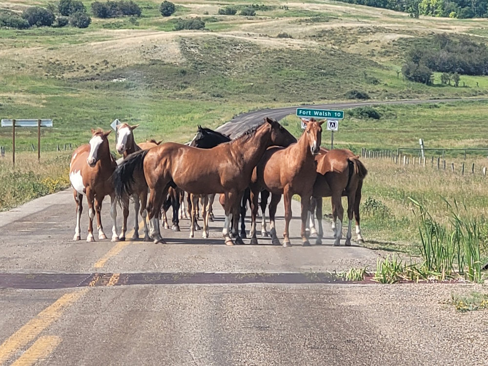
We ran into these horses (not literally) both times we’ve gone to Fort Walsh, so I suspect it happens to everyone. They are wholly unfazed by your presence nor are they intimidated by the size, or loudness, of your vehicle. Honking does not startle them, never mind incite them to move. Even if you nudge your car right up to them, they refuse to disperse. The only successful path past them is to go around. Thankfully, they do not collect a toll.
The Park Road to Fort Walsh
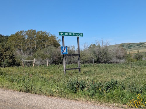
Having outwitted the equine thugs, you’ll soon pass a gravel parking lot on your left. This is the trailer drop-off area. Over the next two kilometres, you navigate three switchbacks as you climb up to the top of the Cypress Hills. These switchbacks are quite tight and some sections between them have steep inclines. Ditching your trailer here will make getting to the fort easier and less costly.
Once you’re beyond the switchbacks, things both level out and straighten out for the remaining 7.5km to the Fort Walsh parking lot.
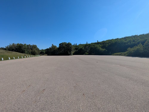
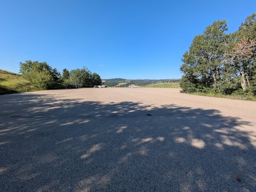
The Parking Lot
This paved parking lot has two conjoined segments. I have no idea if it is ever full. Hell, I’d be stunned if it ever was. But, needless to say, there is plenty of parking available including space for anyone brave enough to haul their big RVs all the way to the fort.
On the other hand, there is very little shelter so expect your vehicle to be baked in the sun. Aside from a couple sweet spots around the parking lot’s rim, there is little shade to park under. Even those sweet spots will only protect a small portion of your vehicle. And, of course, with a rotating Earth, none of these shaded spots stay as such all day long.
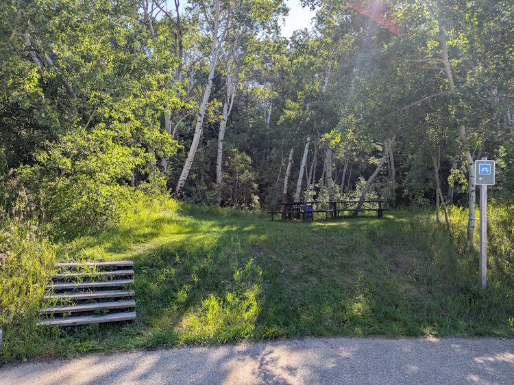
Nestled in the trees to the east of the southern parking lot is a small picnic area. A few wooden steps climb up to a grassy nook with a couple of picnic tables and garbage/recycling bins. It’s a cute little spot for those of you who’ve brought your own lunch, I suppose, but it doesn’t feel like you’re actually lunching at the fort. It’s got more of a roadside rest stop vibe.
Getting to the Visitor Centre
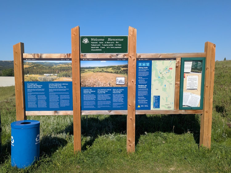
At the southwest end of the parking lot is a paved walkway that takes you to the visitor centre. Just to the side of where this walkway starts is a large welcome sign with information and a map about both Fort Walsh and the Cypress Hills.
The walkway lazily winds its way down to the visitor centre’s entrance. The slope is gentle enough for most folks, including those in wheelchairs. If you do require more direct access to the entrance, you can do so via the access road by bypassing the parking lot.
The Fort Walsh National Historic Site Visitor Centre
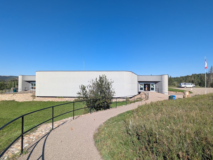
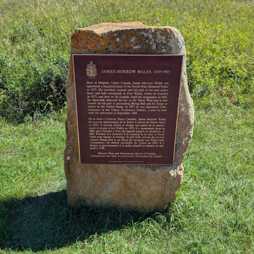
The Fort Walsh visitor centre is an interesting, modern building that almost hides in its surroundings. Extensively refurbished in 2016, the visitor centre is a little slice of civilization in the wild. Before entering be sure to read the James Walsh commemorative plaque next to the flagpole.
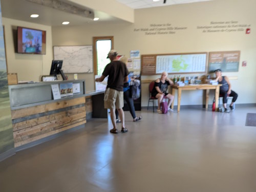
Upon entry, you’ll be greeted by friendly Parks Canada staff who will collect any visitor fees and help you plan your visit at Fort Walsh. They can also help with any questions you might have about the Cypress Hills and surrounding park.
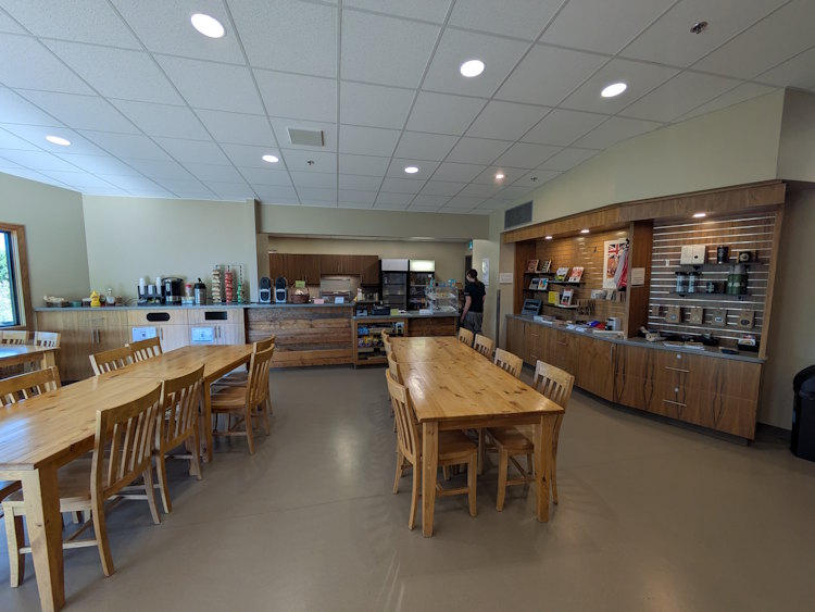
Interpretive Area, Bathrooms, Café, and Gift Shop
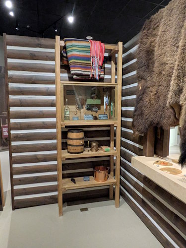
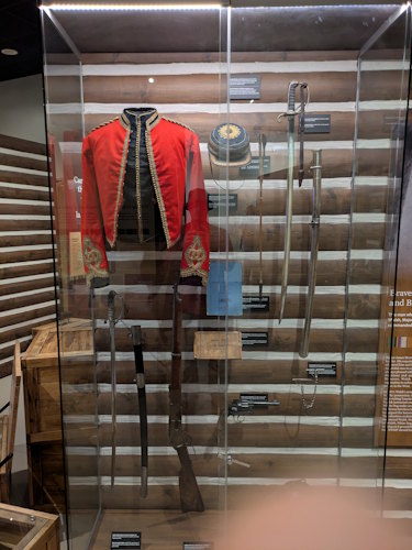
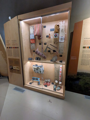
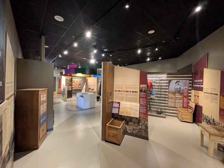
From the service desk, a hallway takes you to the various offerings within the visitor centre. To your left is the large interpretive area which has many educational displays and artifacts pertaining to both Fort Walsh and First Nations peoples. Exploring this area is a great way to familiarize yourself with the history of this place in the comfort of air conditioned indoors.
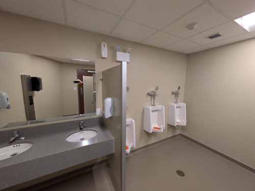
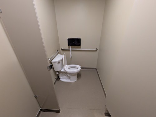
To your right, down the hallway, are the bathroom entrances. These are fully modern washrooms with urinals, flush toilets (including accessible stalls), and sinks with hot water. A water bottle filling station is on the wall in the hallway which you will definitely want to use before heading outside. And again, once you’re returned from the outside.
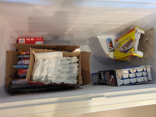
The hallway opens up to a café and gift shop space. The café has beverages, snacks, and what the official website calls, packaged foods. There’s also a deep freeze filled with ice cream treats and freezies, something you’re likely going to crave on a sunny August afternoon after you complete the Battle Creek Trail hike.
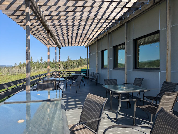
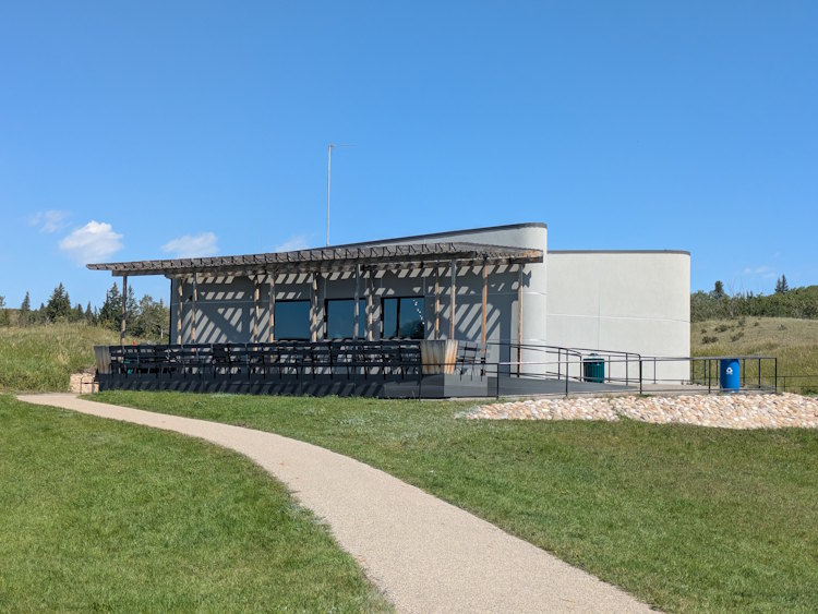
If it isn’t too hot, or you just happen to love excessive warmth, there is also a patio just outside the café. The overhead pergola provides dappled shade for the tables beneath. In the morning, the visitor centre wall also provides some shade, but like in the parking lot, that shade diminishes as the sun moves westward.
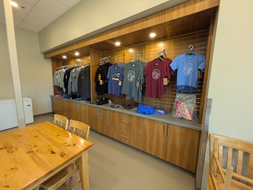
The gift shop is found along the walls surrounding the café eating area. It includes Parks Canada and Fort Walsh branded items from travel mugs to books to clothing and more. I almost bought a shirt on our second trip but unfortunately, they did not have my size.
The Path to the Fort
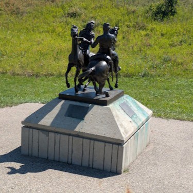
Having taken in all the visitor centre has to offer, it’s time to get down to Fort Walsh proper. You exit the visitor centre via the patio where the paved pathway continues southward for another sixty metres. As you progress, you’ll pass a memorial sculpture and then the famed Parks Canada red Adirondak chairs.
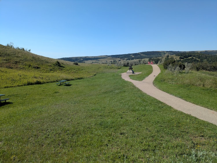
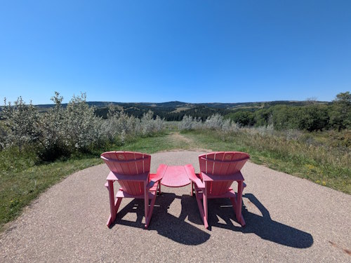
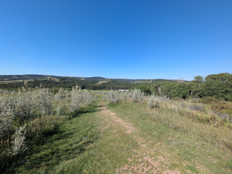
Those chairs offer a lovely view of Fort Walsh and the surrounding Cypress Hills. They also demark the end of the paved walkway. Getting to the fort from this point will require descent along a dirt, foot-trodden path. For anyone incapable, or unwilling, to make such a trek on foot, the visitor centre offers a free shuttle service to and from the fort.
Fort Walsh
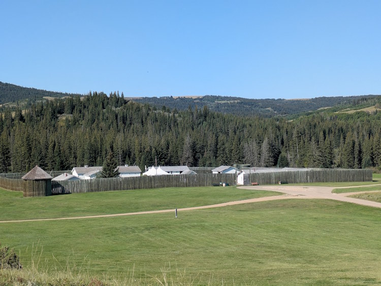
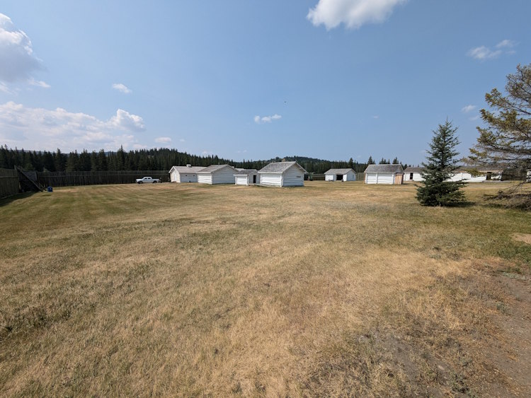
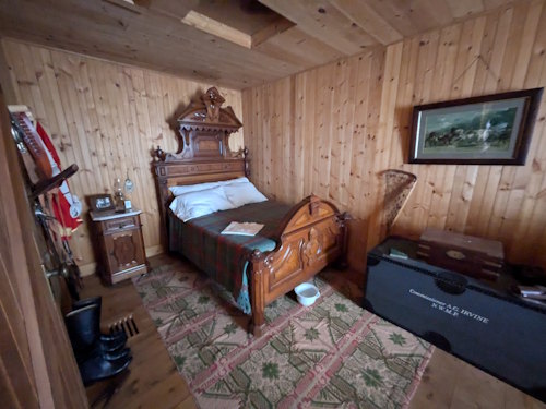
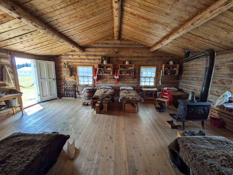
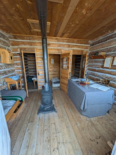
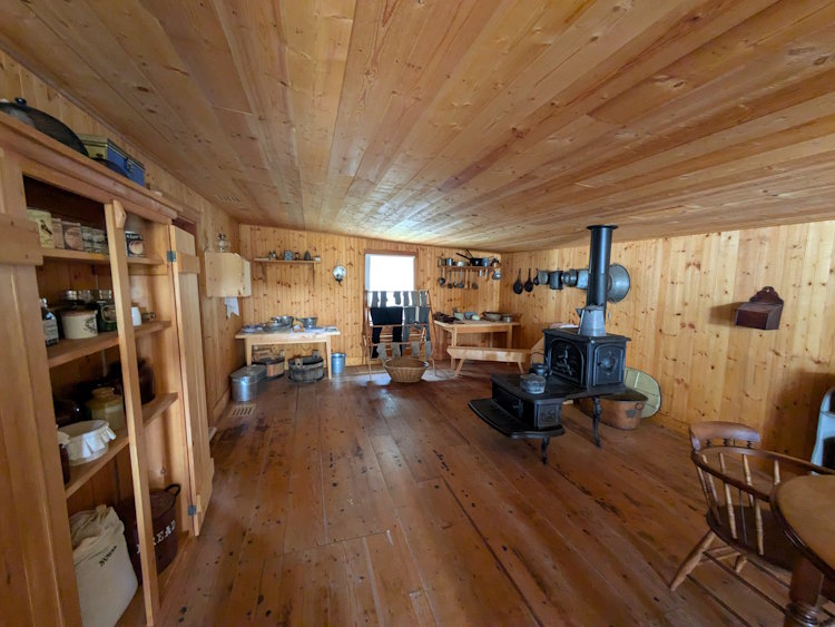
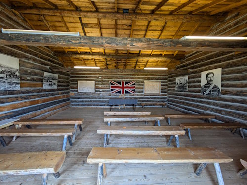
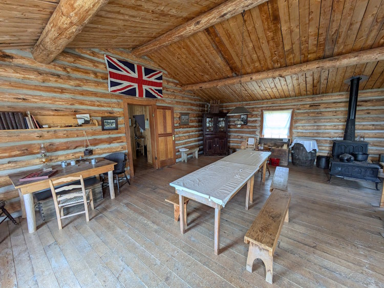
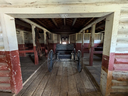
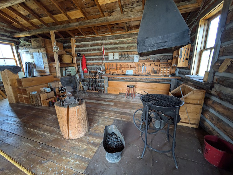
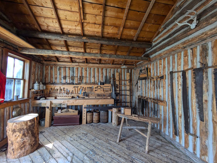
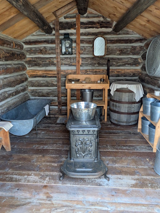
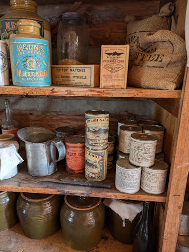
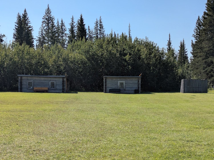
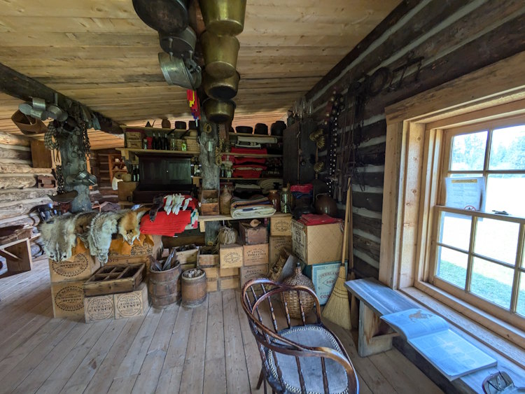
Fort Walsh is comprised of twelve buildings inside a stockade with two turrets at opposing corners. The fort grounds are mowed lawn both inside and outside the stockade and are relatively flat. Buildings vary in size and include barracks, superintendent’s quarters, prison, stables, and workshops. It’s a veritable pioneer village in there and you’ll see plenty of fascinating relics from the late 19th century.
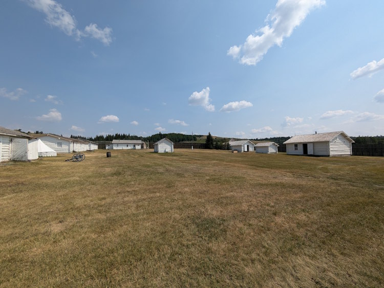
You can explore the fort buildings on your own or enjoy a guided tour. It’s a little confusing figuring out the tours and cost for each. With current government incentives providing free admission, it’s possible to get in-person guidance around the fort without specifically paying for it. And there are period-dressed, in persona there as well that’ll show you around.
I guess what I’m trying to say is that we got a bit of a tour through the fort buildings by a delightful young man dressed up as an NWMP officer. We did not pay for this service, but neither did we request it prior to accessing the fort. It was certainly more educational than just snooping around on our own. And there are enhanced programs for guests and school children throughout the season. Your mileage may vary.
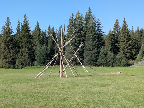
Métis Trading Post
Outside the walls, and a little further south, you may pass the skeleton of a couple teepees as you make your way to a replica Métis trading post. These log cabin style structures are also filled with period relics such as animal furs, canned goods, hardware, and blankets.
As in the fort, you can enter look around inside these buildings and most likely encounter another actor portraying a Métis trader. When we visited, whomever was playing this role was very much into his character which made for an interesting encounter indeed.
Still further southward, you’ll come to a picnic area that marks the trailhead for the Battle Creek Trail. This roughly six-kilometre hike is a great way to round out your Fort Walsh visit with lovely vistas and little more history. Read my detailed account of that hike, here.
Is Fort Walsh National Historic Site Worth Visiting?
Before I wrap this up, I should probably mention that there is a NWMP cemetery on site. It’s a bit out of sight, northwest of the visitor centre and none of the paths take you directly to it. Visiting it is not forbidden, but we chose to let the men rest in peace, so I haven’t got a picture of it for you.
I enjoyed both our visits to Fort Walsh National Historic Site, with the Battle Creek Trail hike being a particular pleasure. If you’re camping at Cypress Hills Interprovincial Park, I highly recommend adding it to your itinerary for half a day.
If you’re traveling across Canada, it’s not a terribly inconvenient detour from the TransCanada. Go learn some Canadian history from the “wild west” days. Southwest Saskatchewan prairie is a fascinating, ghostly place with Cypress Hills an oasis in their midst. Sometimes a ways away is worth the effort.
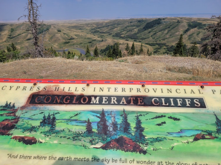
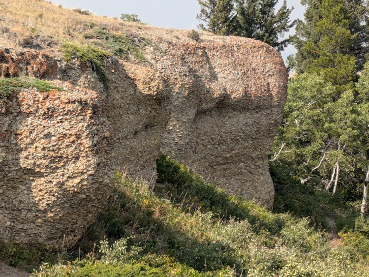
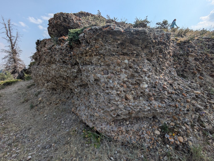
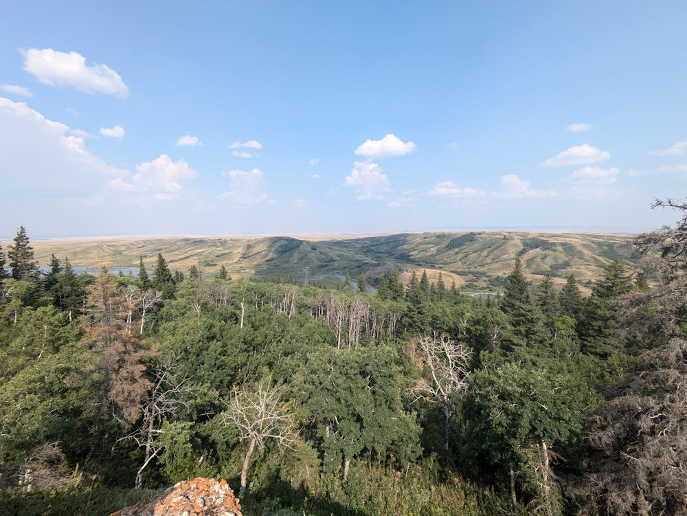
Conglomerate Cliffs
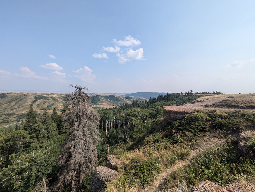
And if the visitor centre, fort, and hike aren’t quite enough for you, add in the Conglomerate Cliffs. Found 12.5km north of Fort Walsh, these cliffs offer a peek at the geologic formation that helped preserve the Cypress Hills in the face of millennia of relentless erosion by rain, wind, and glaciers. As a geology lover myself, I couldn’t resist checking them out. Good views here, too.